| Data below is for the meeting on October 9, 2011 |
| Legislative Merge Exports |
|
|
|
|
|
|
| Data below is for the meeting on October 3, 2011 |
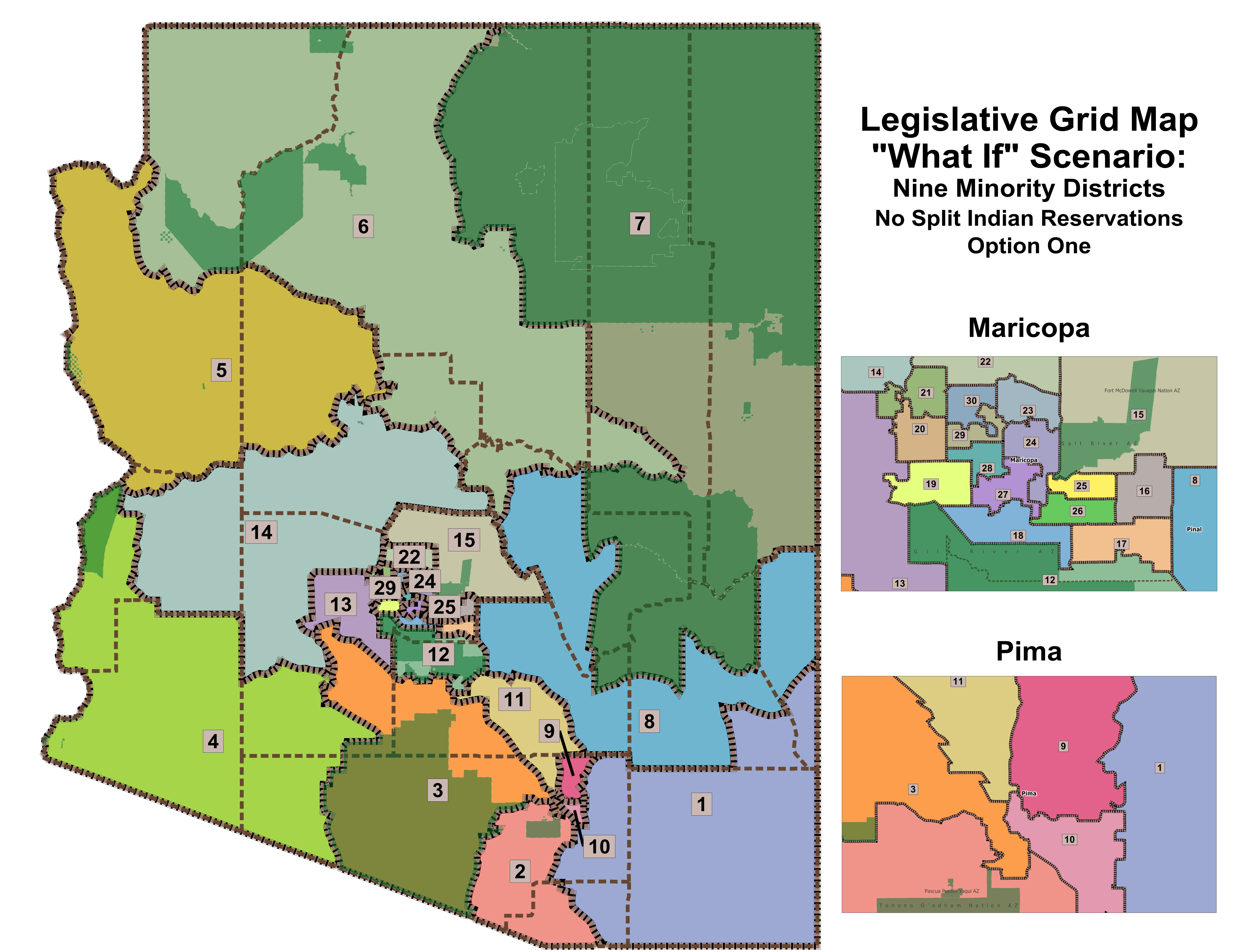
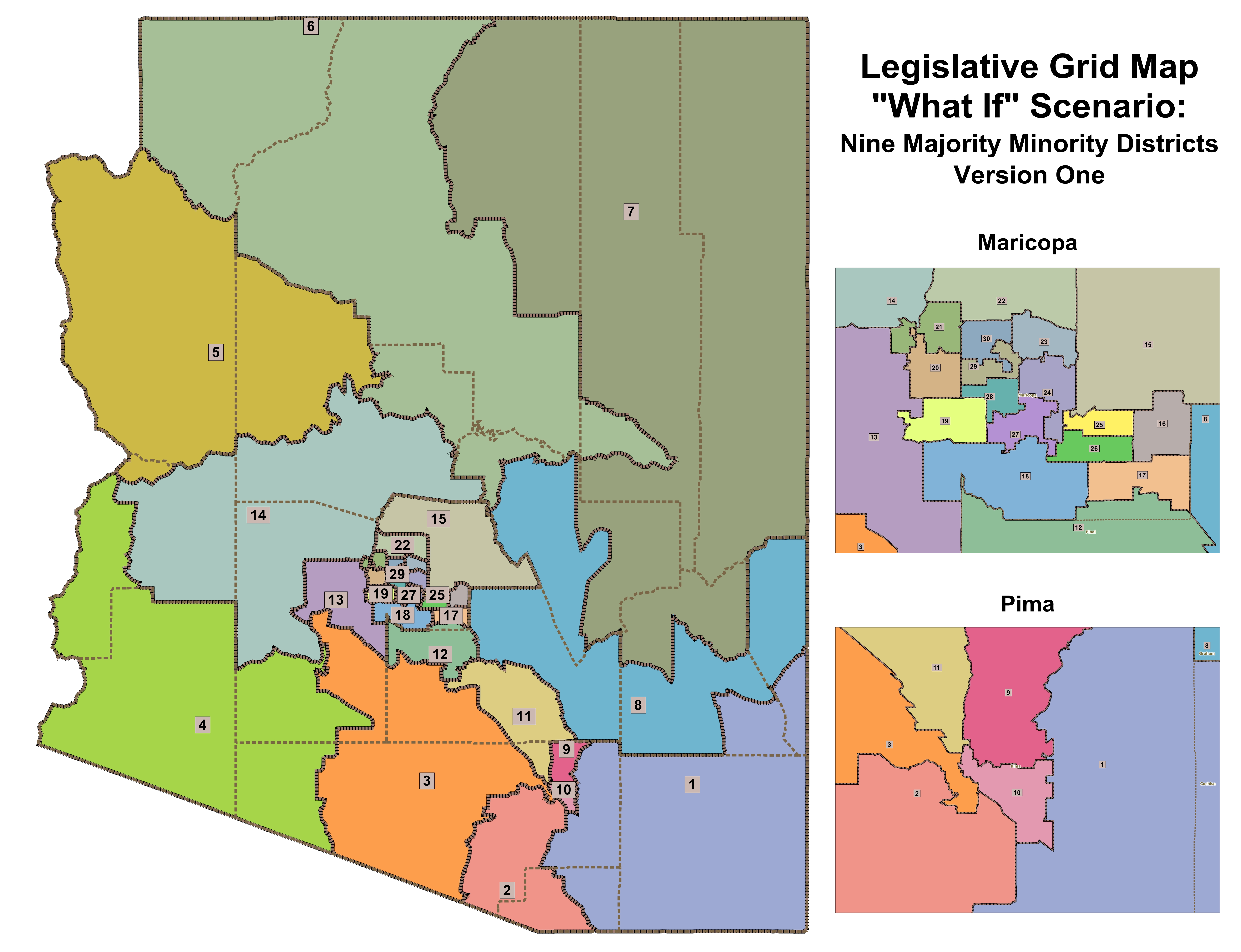
| "What If" Legislative 9 Minority District option 1 version 8a |
|
|
|
|
|
|
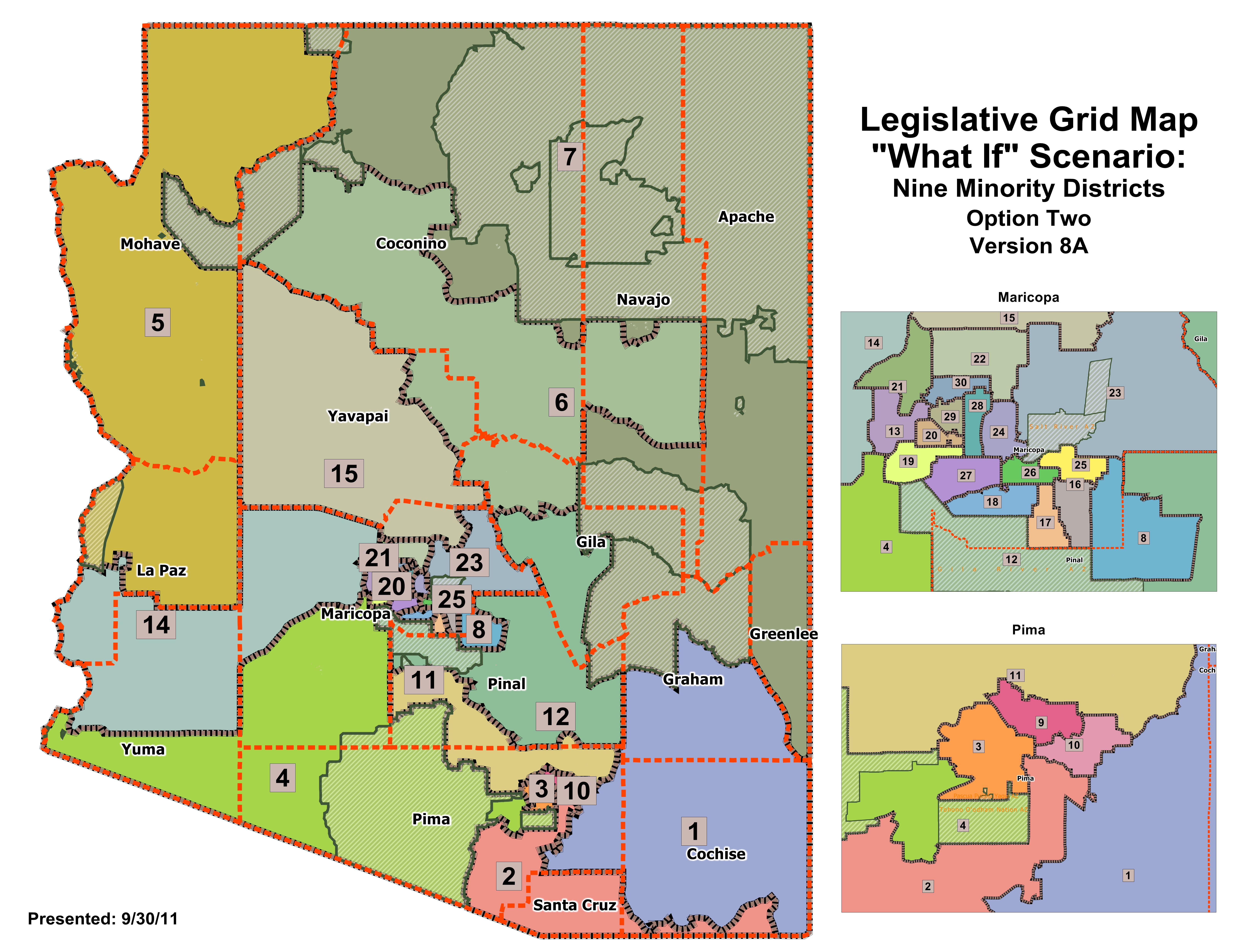
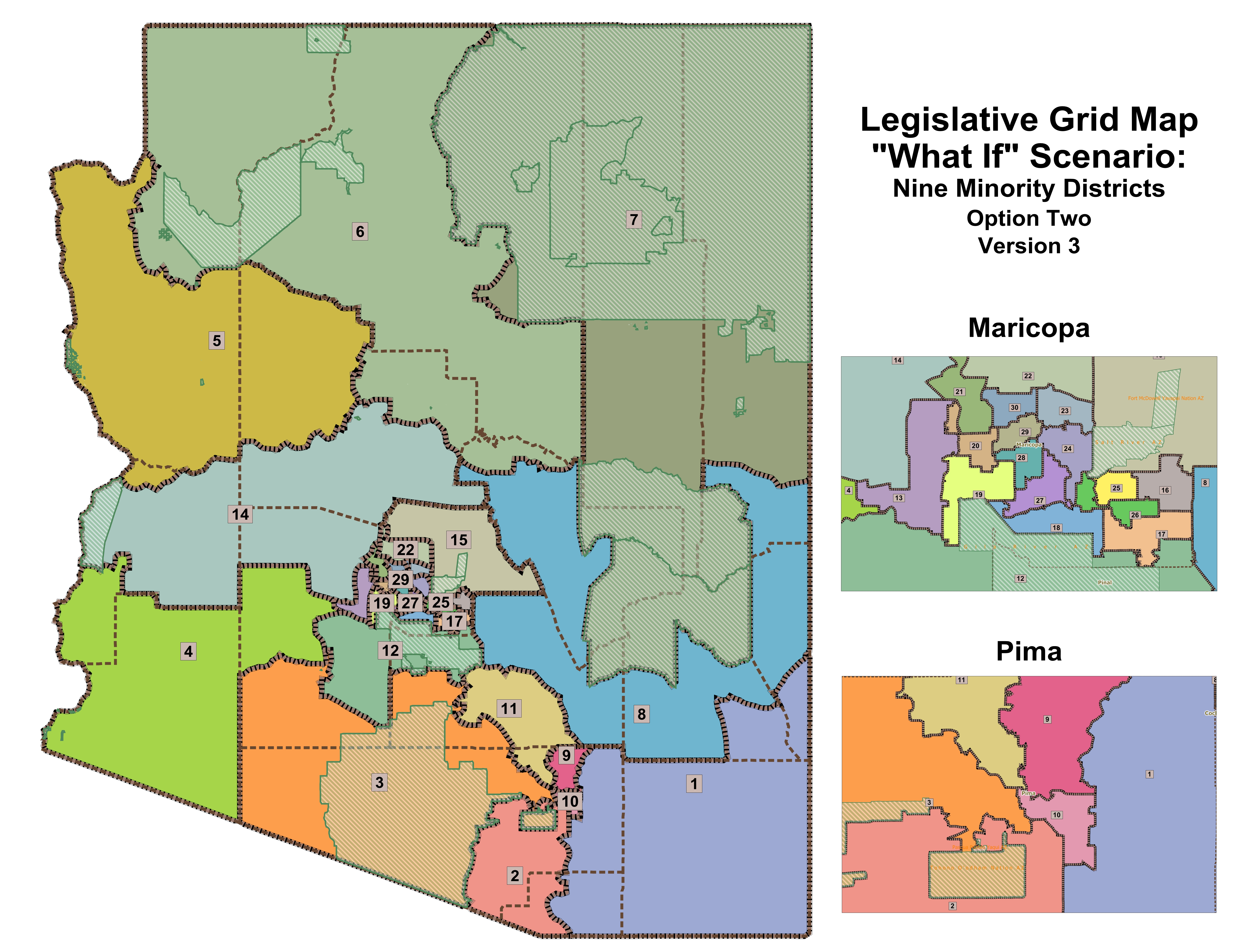
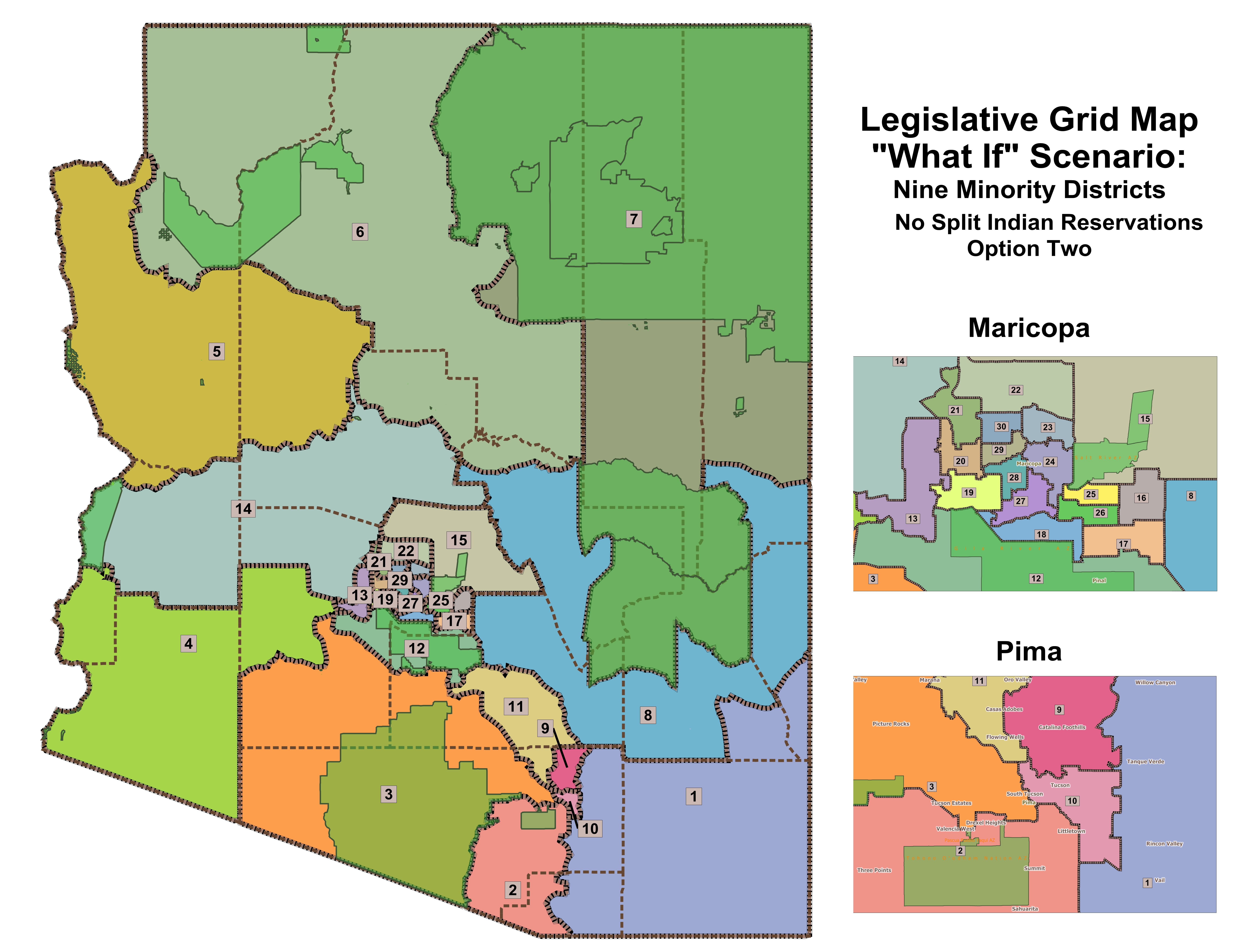
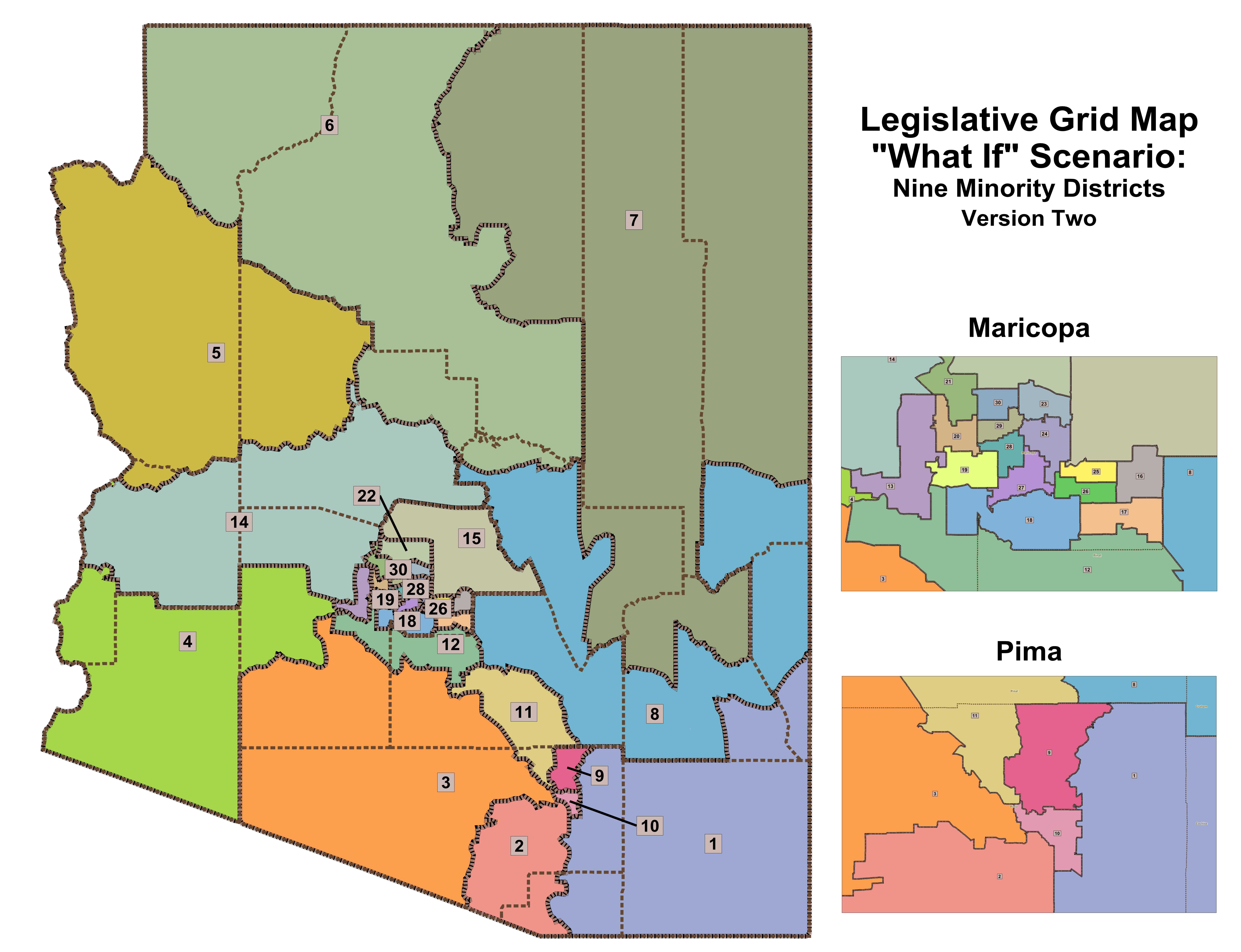
| "What If" Legislative 9 Minority District option 2 version 8a |
|
|
|
|
|
|
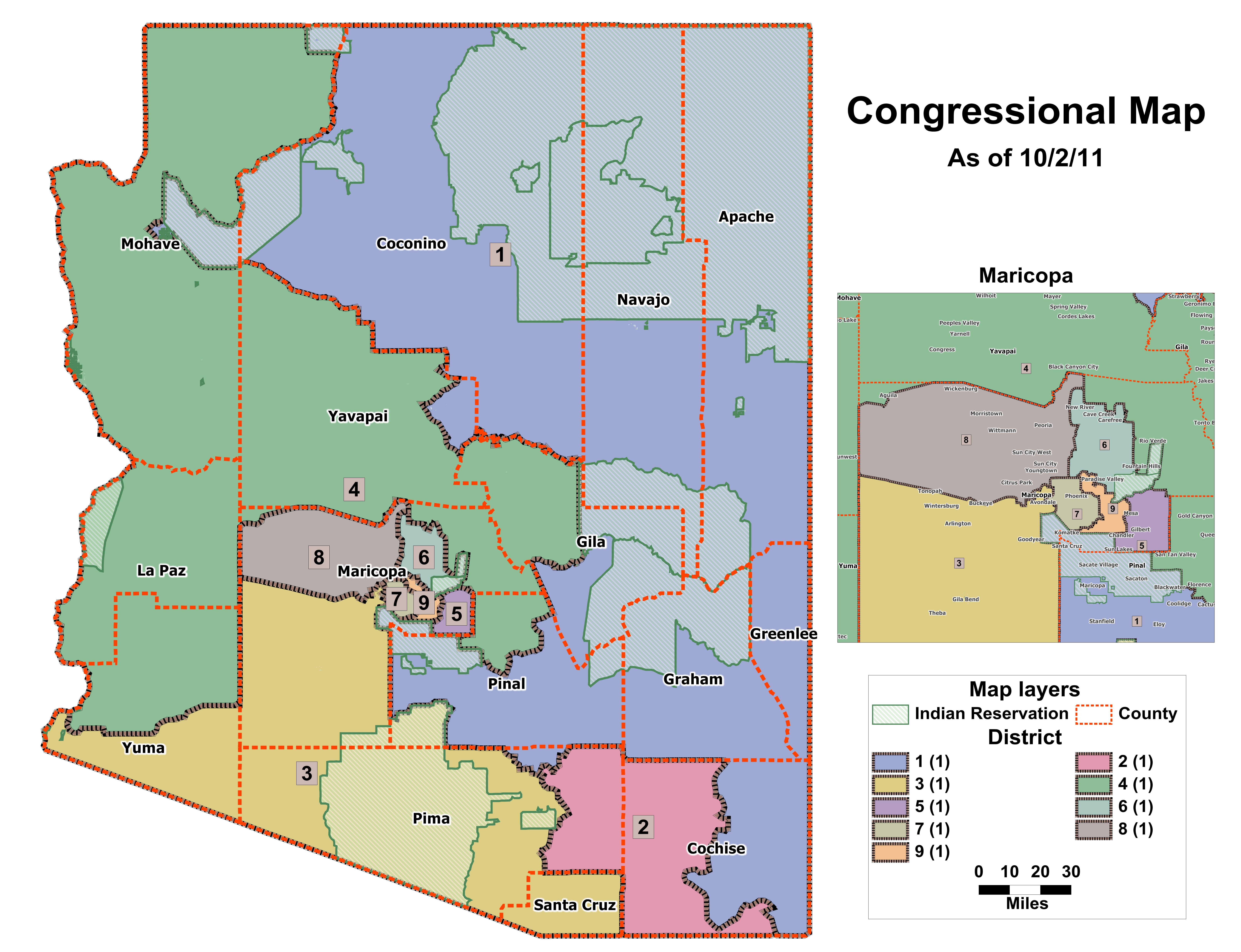
| Congressional Map as of 10/02/11 |
|
|
|
|
|
|
| Congressional Map as of 10/01/11 |
|
|
|
|
|
|
| Data below is for the meeting on September 30, 2011 |
| Congressional Map as of 6:30pm 9/30/11 |
|
|
|
|
|
|
| Data below is for the meeting on September 29, 2011 |
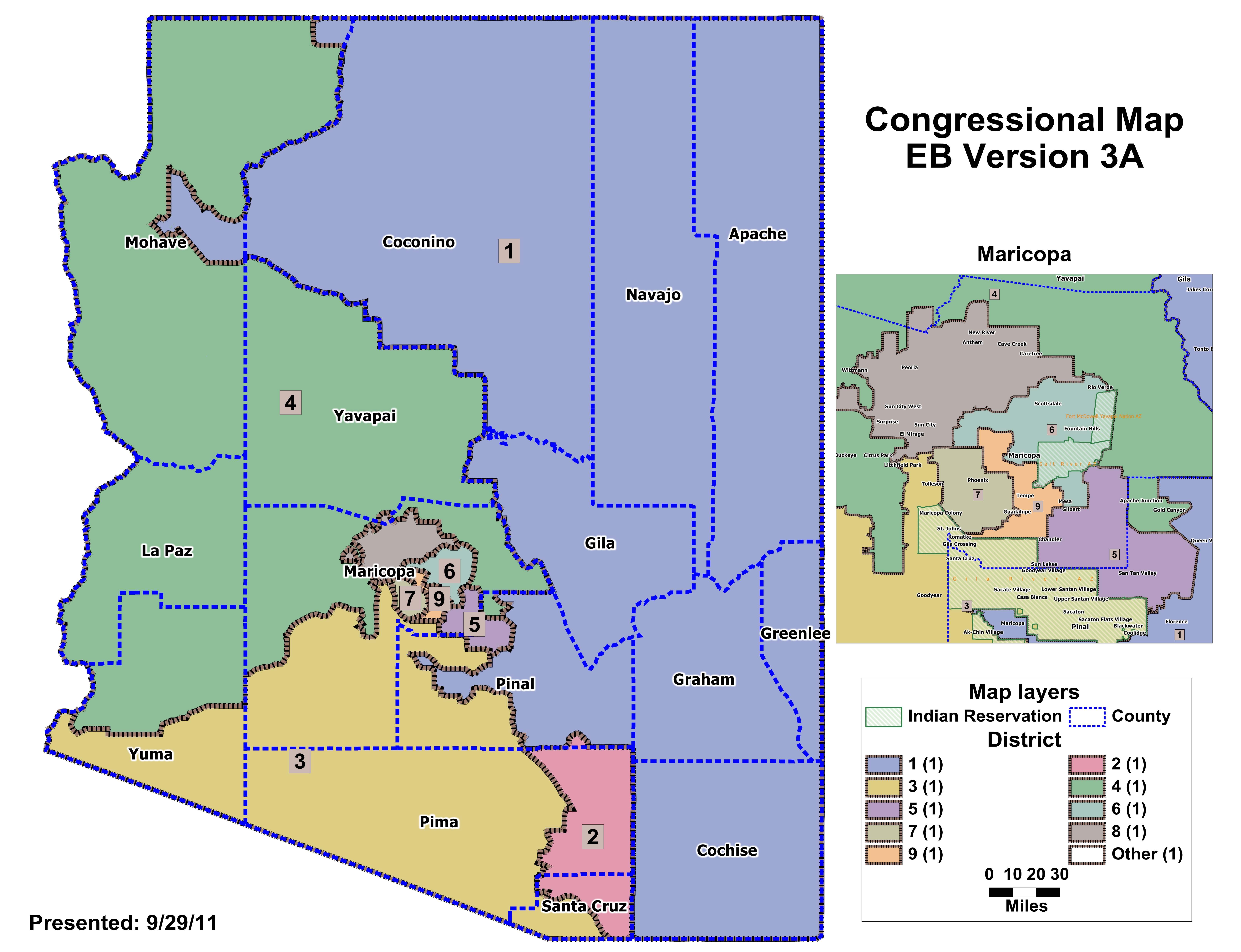
| "What If" Congressional EB v3a |
|
|
|
|
|
|
| Data below is for the meeting on September 27, 2011 |
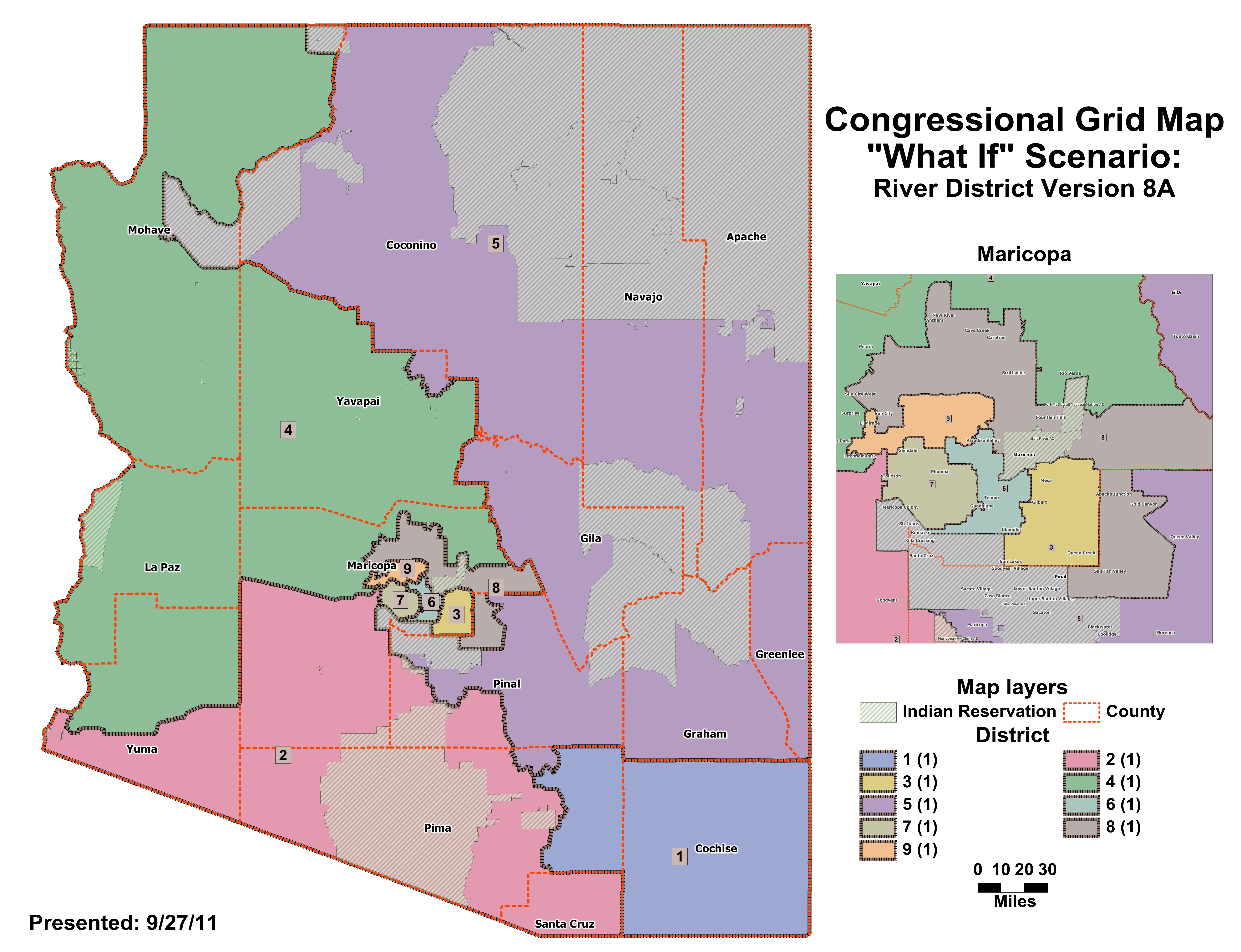
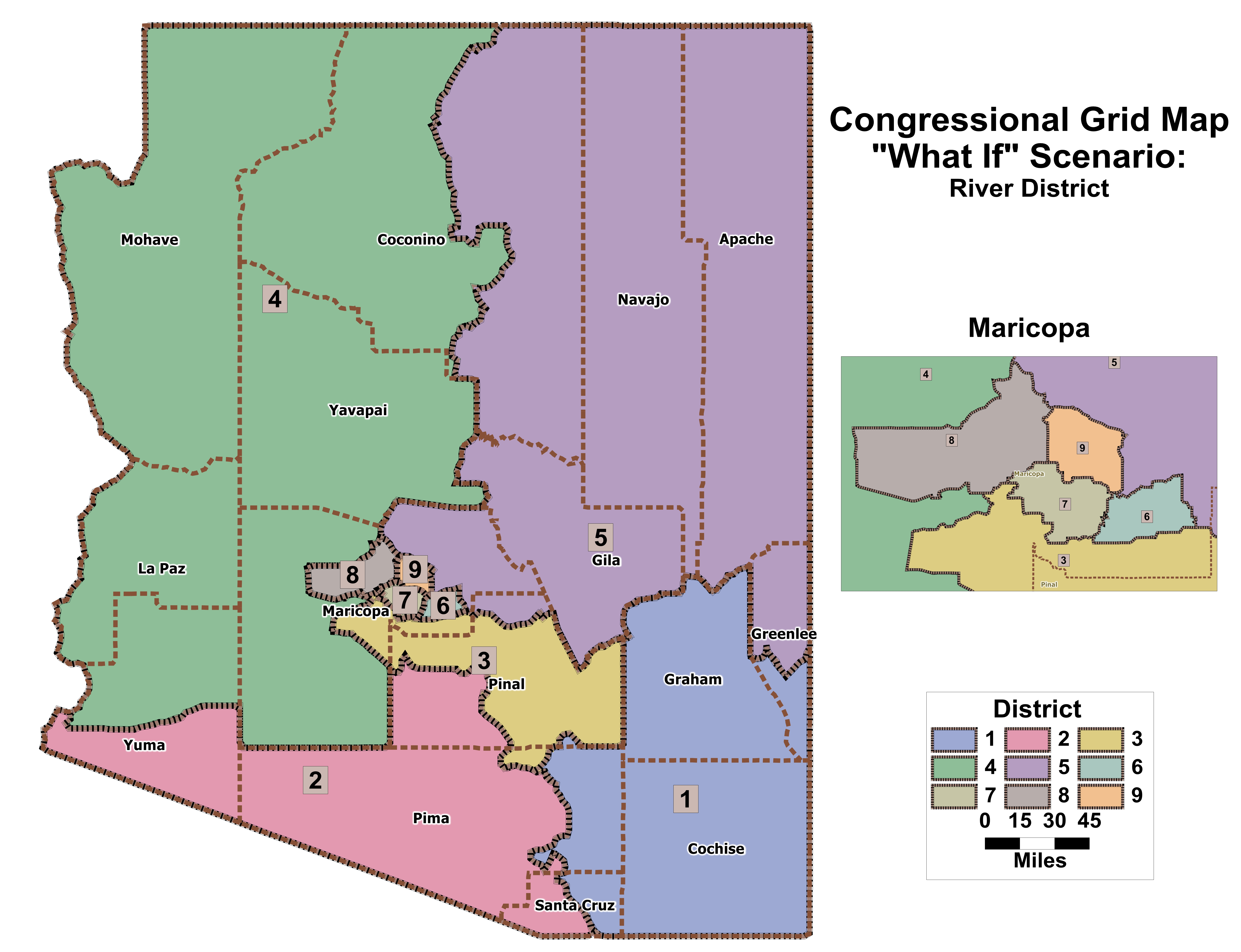
| "What If" Congressional River District version 8a |
|
|
|
|
|
|
| "What If" Congressional Whole Counties version 6f |
|
|
|
|
|
|
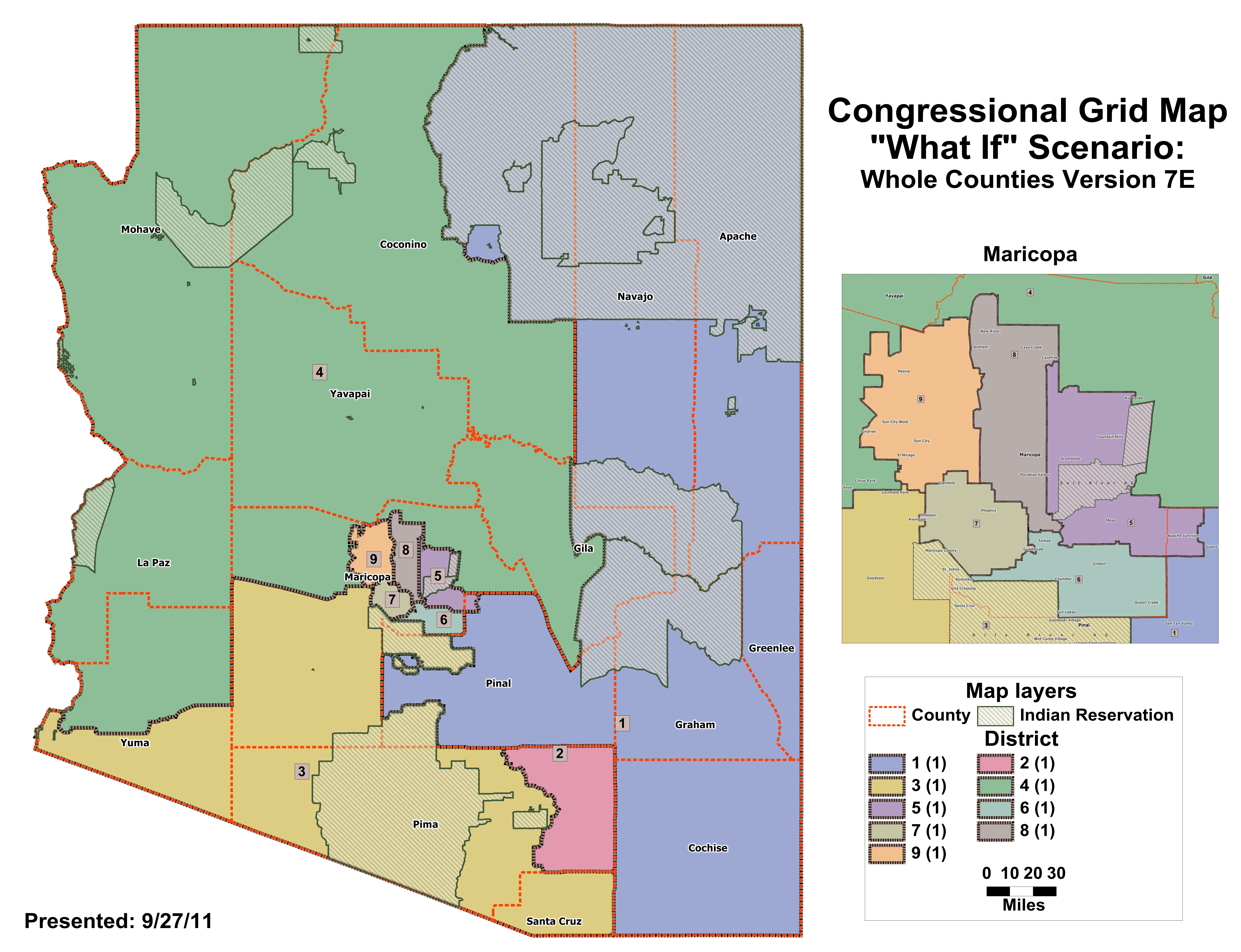
| "What If" Congressional Whole Counties version 7e |
|
|
|
|
|
|
| Data below is for the meeting on September 26, 2011 |
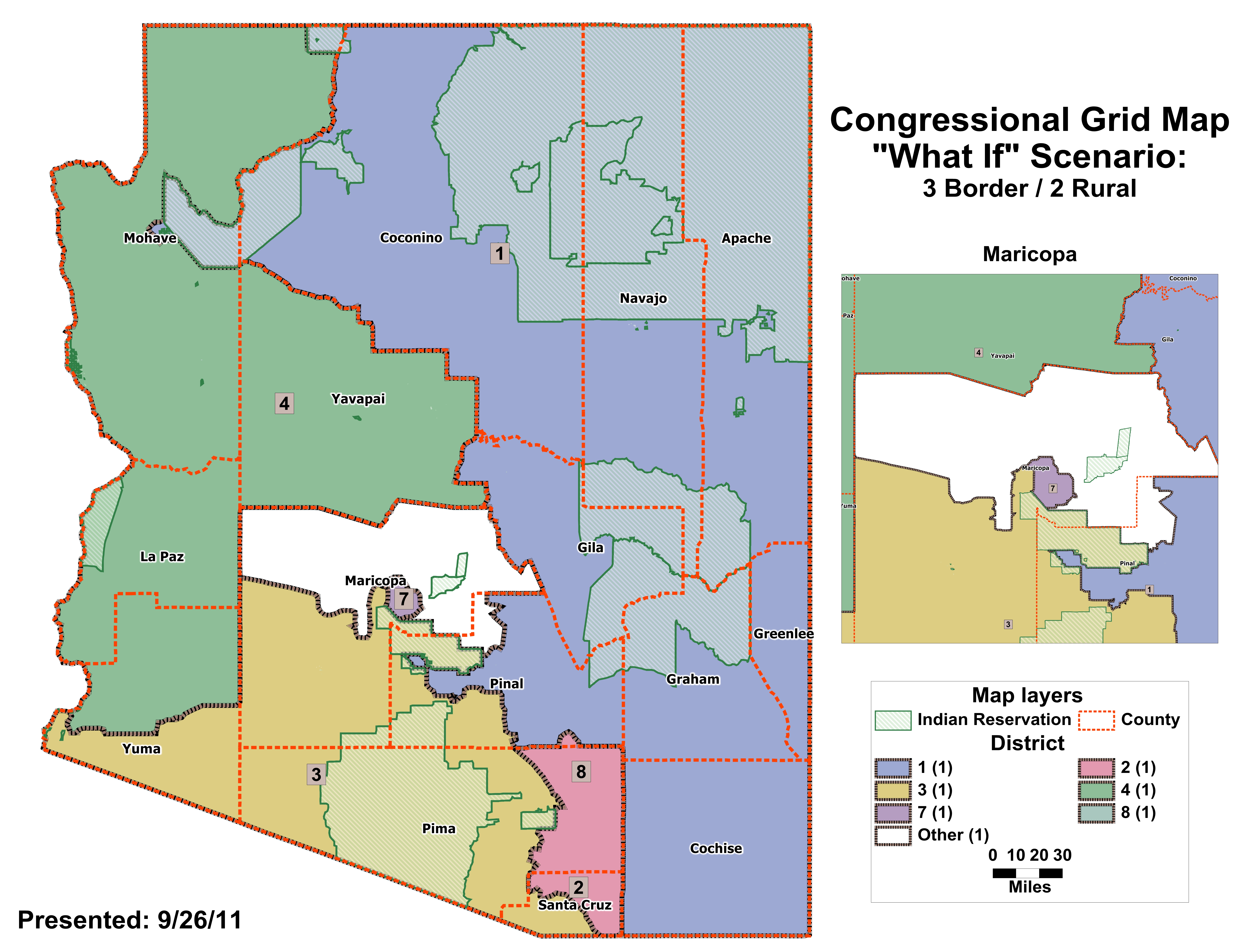
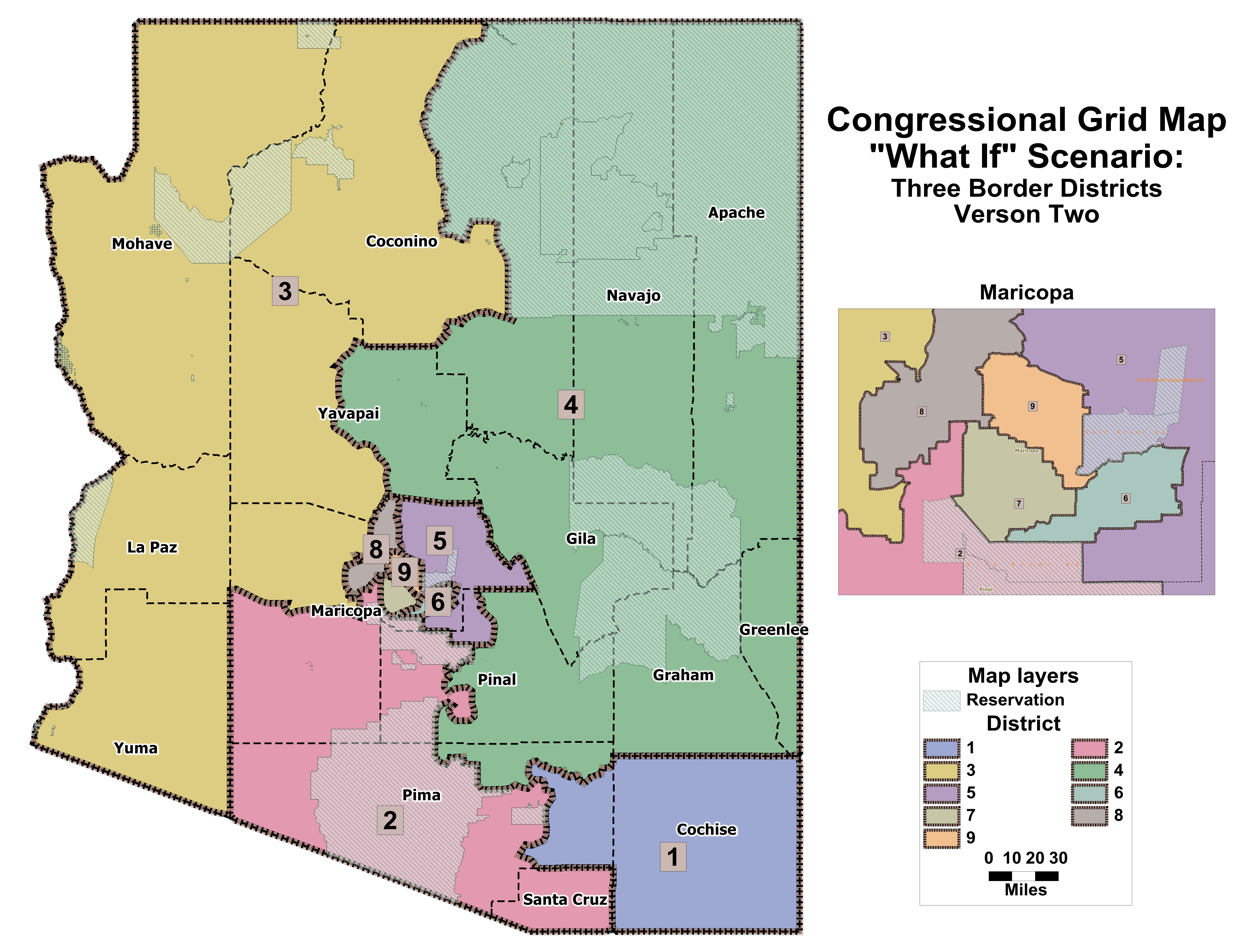
| "What If" Congressional 3 Border 2 Rural 1 Donut version 1a |
|
|
|
|
|
|
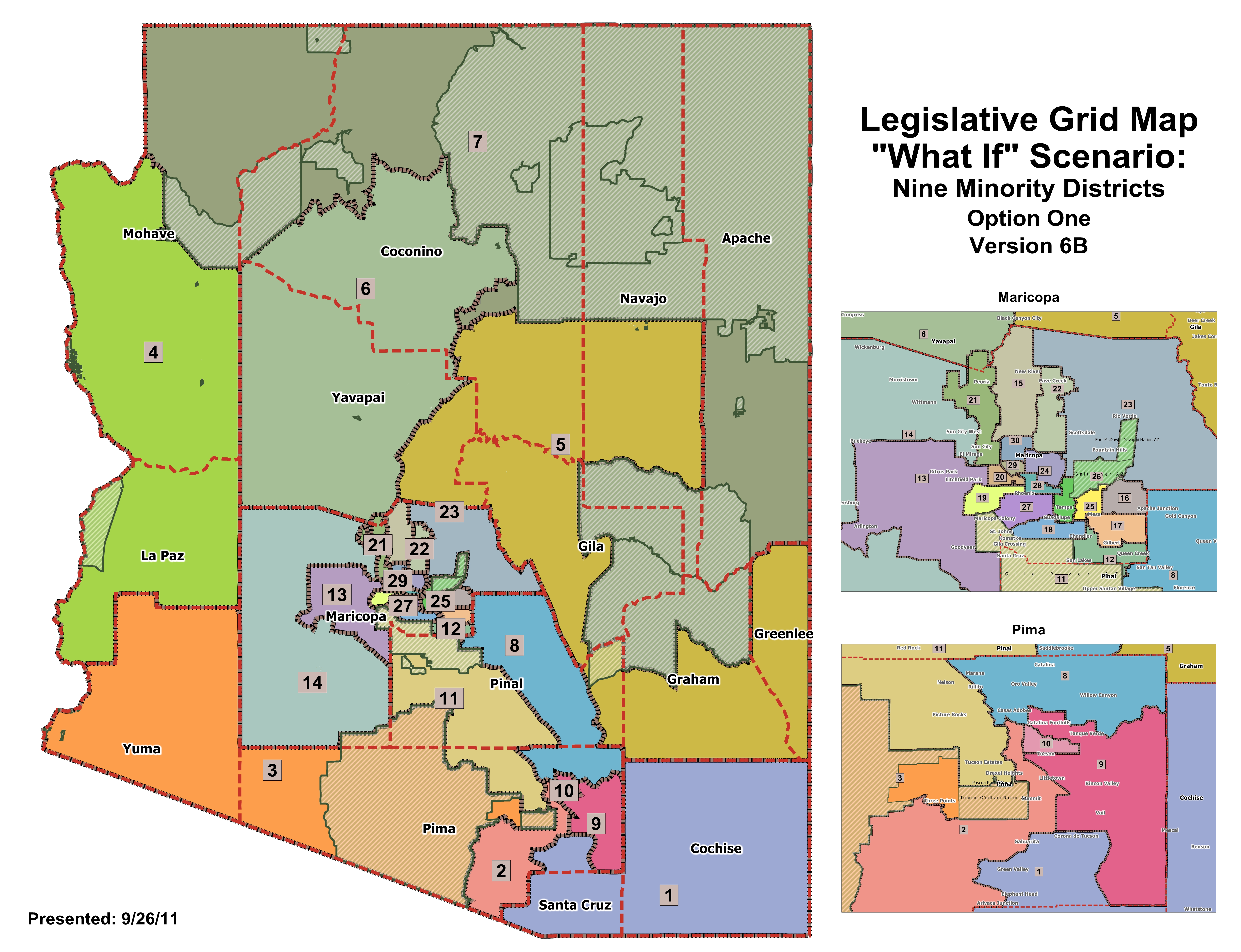
| "What If" Legislative 9 Minority District option 1 version 6b |
|
|
|
|
|
|
| "What If" Legislative 9 Minority District option 2 version 7a |
|
|
|
|
|
|
| Data below is for the meeting on September 22, 2011 |
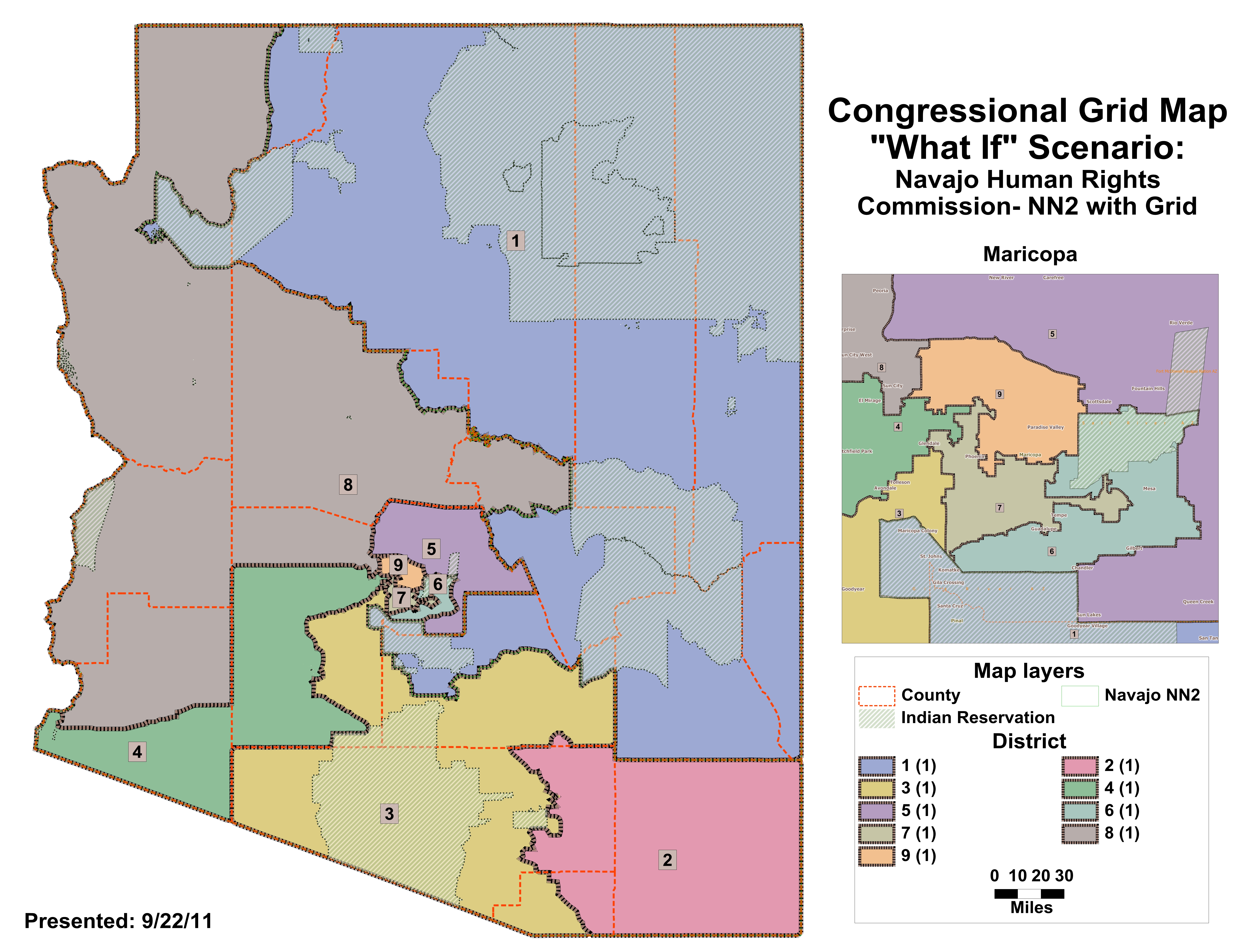
| "What If" Congressional Navajo Grid option 1 v1a |
|
|
|
|
|
|
| "What If"Congressional Navajo Grid option 2 v1a |
|
|
|
|
|
|
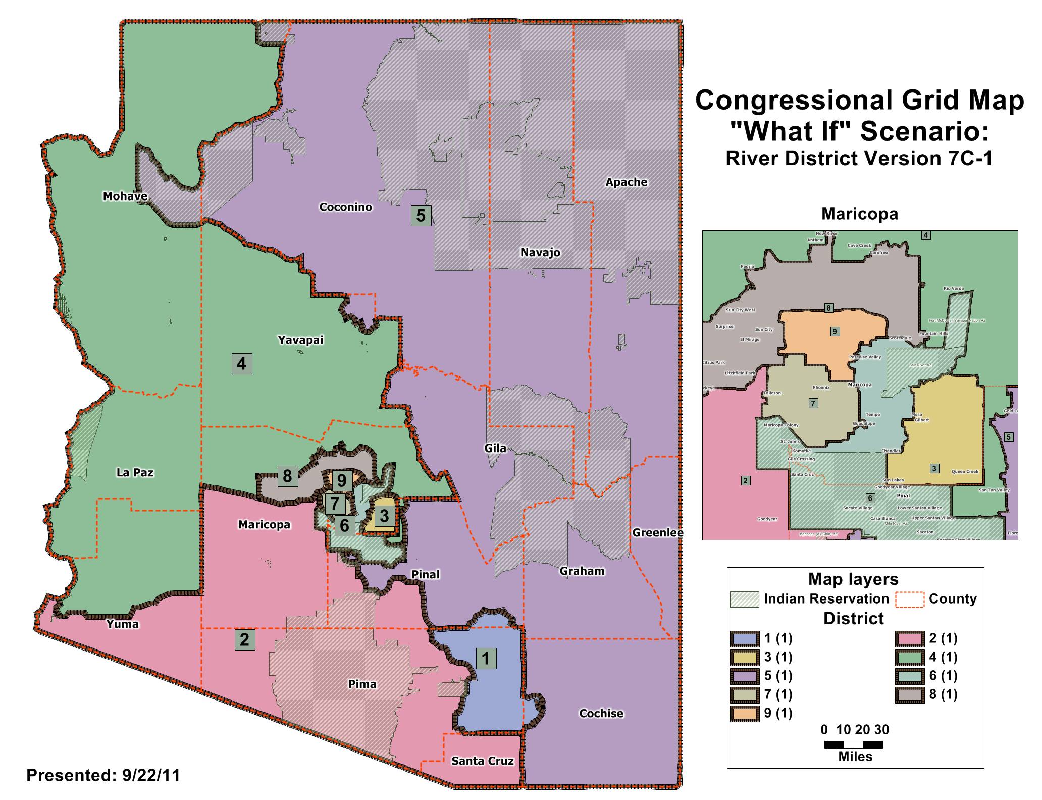
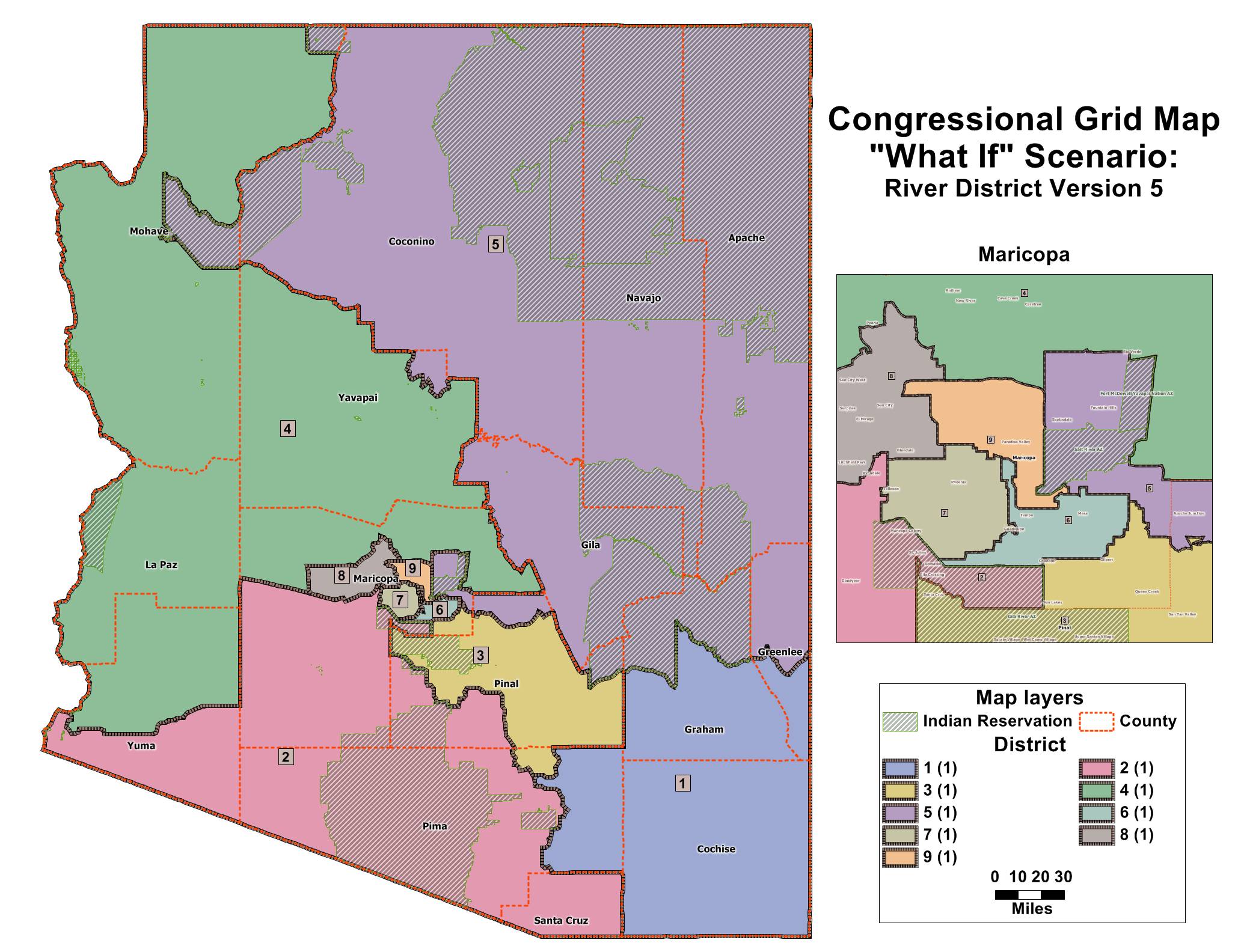
| "What If" Congressional River District v7c1 |
|
|
|
|
|
|
| "What If" Congressional River District v7c2 |
|
|
|
|
|
|
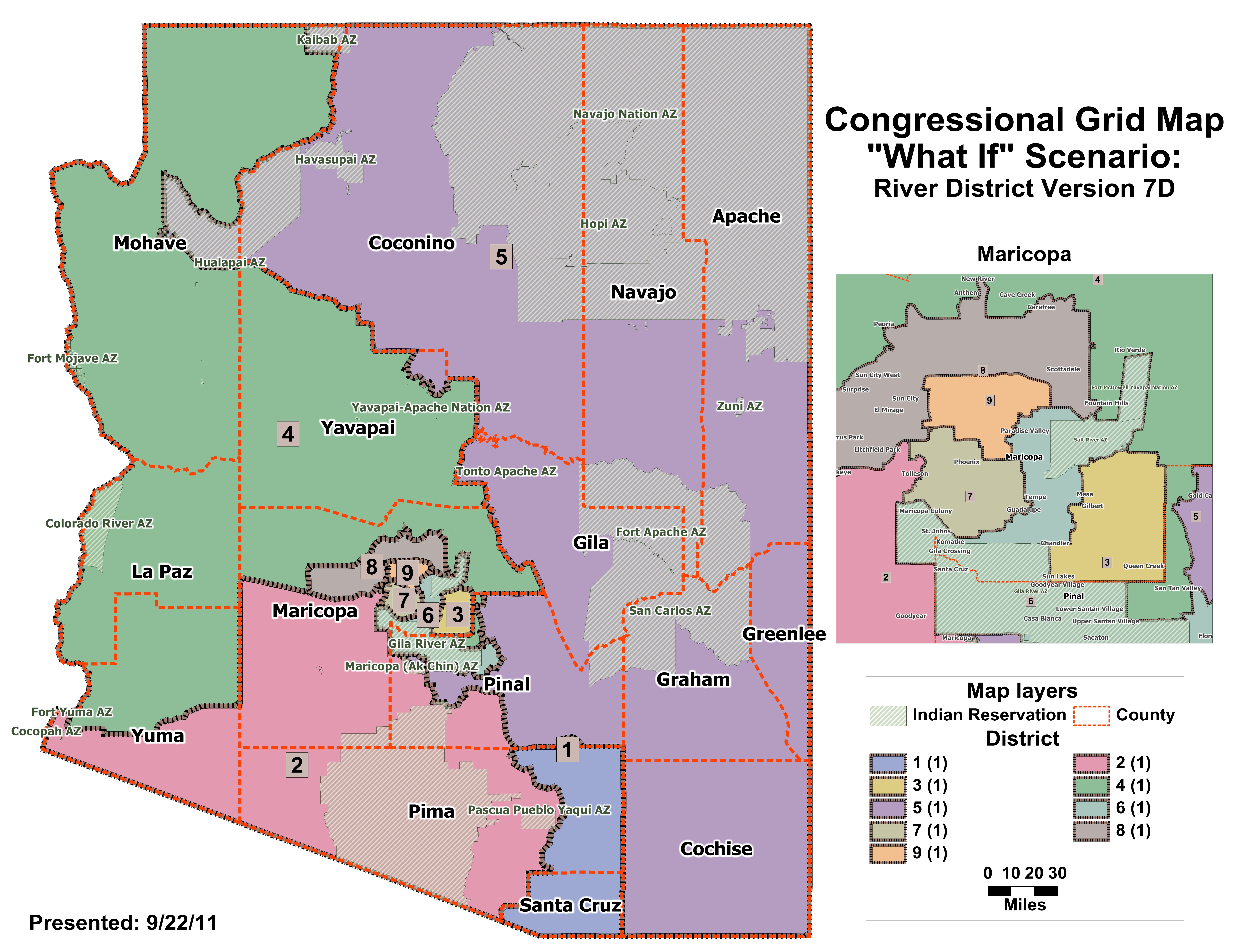
| "What If" Congressional River District v7d |
|
|
|
|
|
|
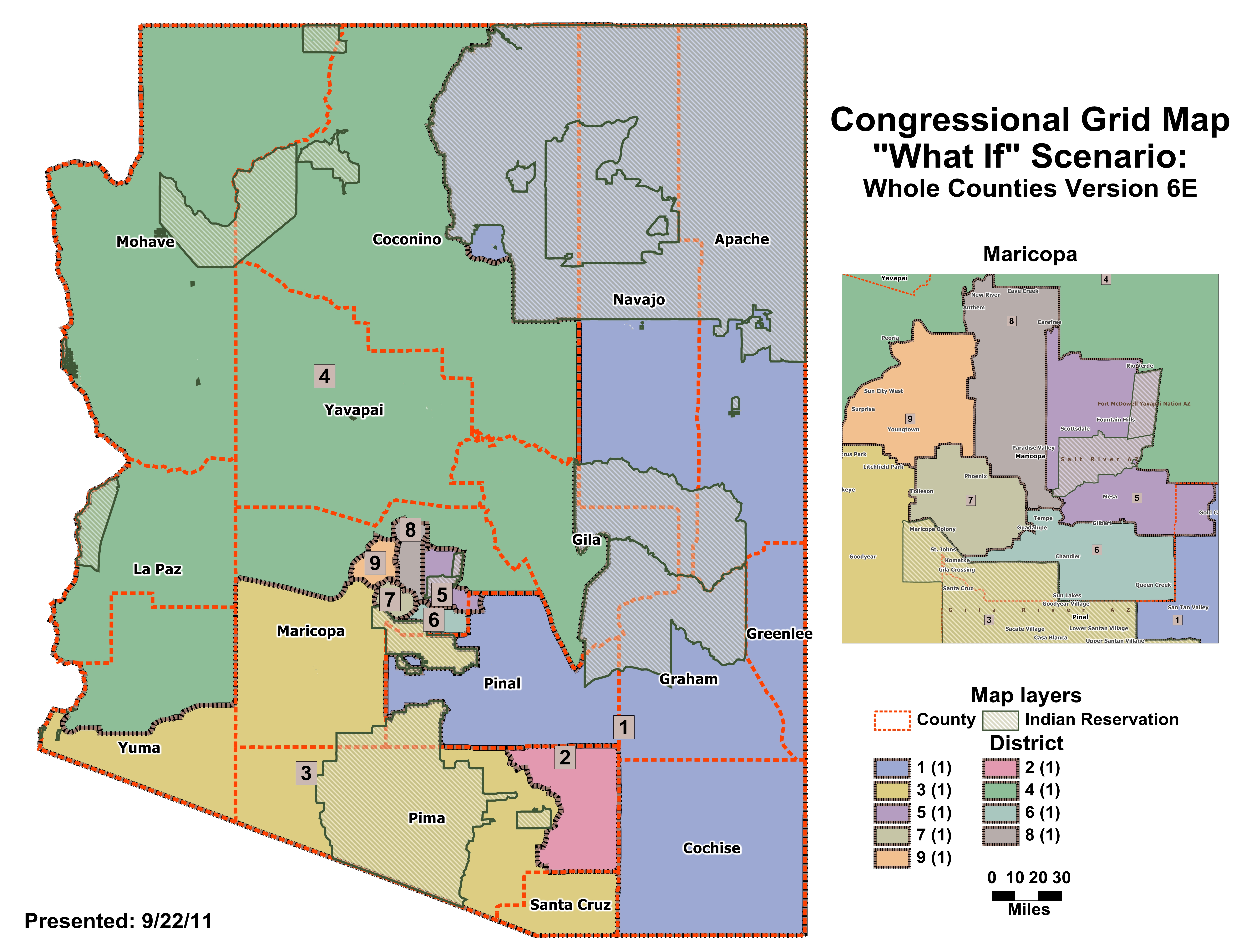
| "What If" Congressional Whole Counties v6e |
|
|
|
|
|
|
| Data below is for the meeting on September 16, 2011 |
| "What If" Congressional Whole Counties V6d |
|
|
|
|
|
|
| Data below is for the meeting on September 15, 2011 |
| Reservation Areas - JPG (30mb) |
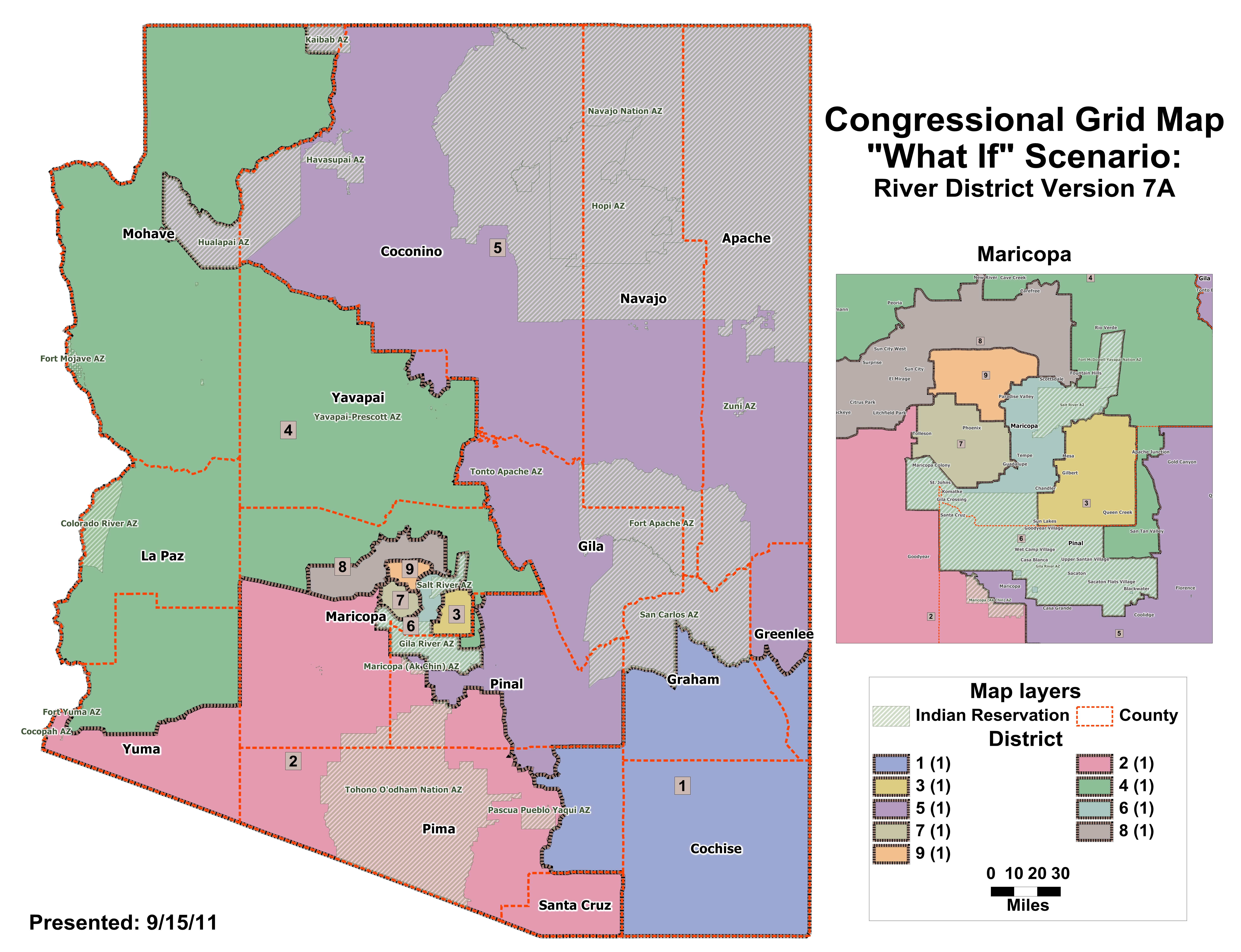
| "What If" Congressional River District v7a |
| Available File Types: |
|
|
|
|
|
|
|
|
|
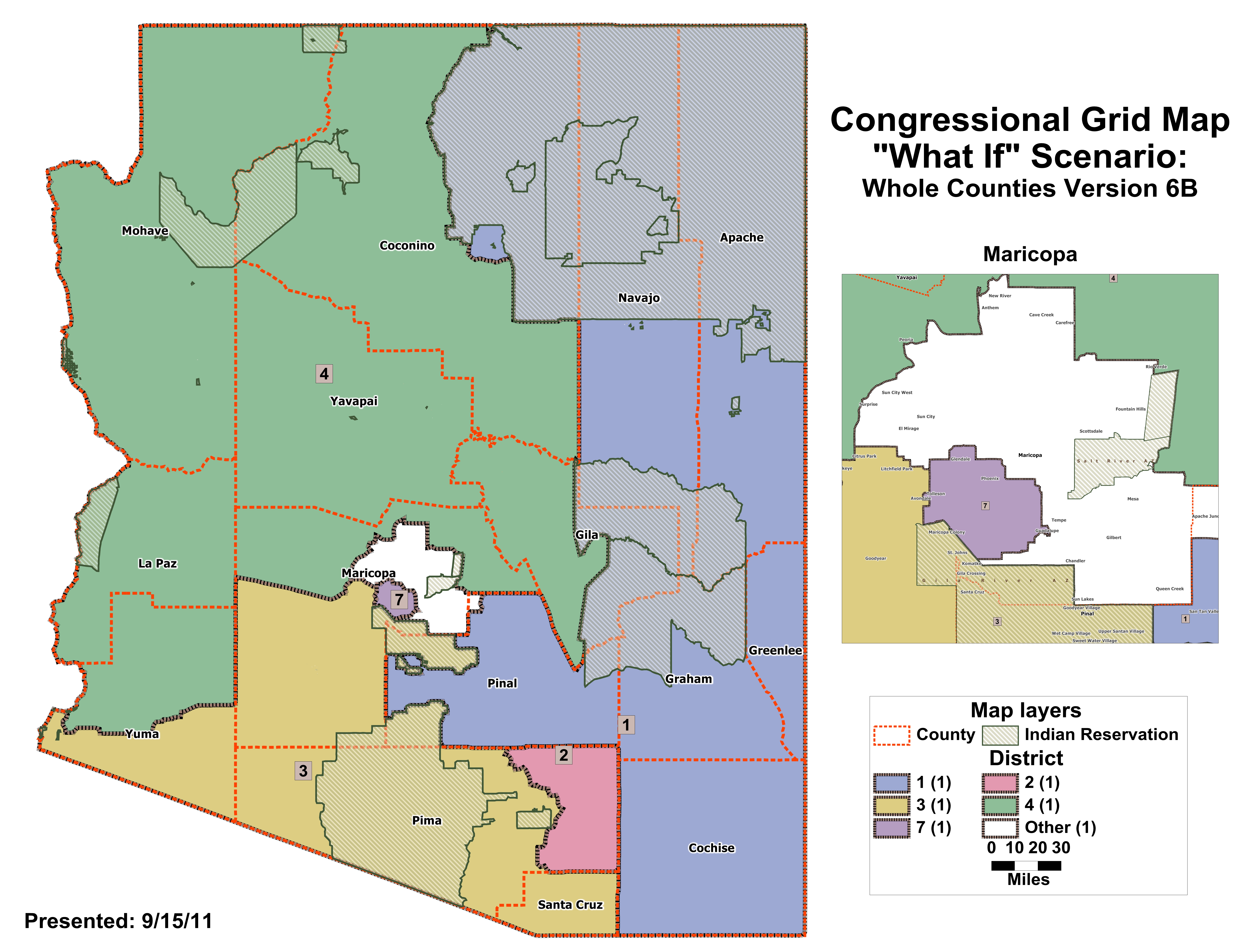
| "What If" Congressional Whole Counties v6b |
| Available File Types: |
|
|
|
|
|
|
|
|
|
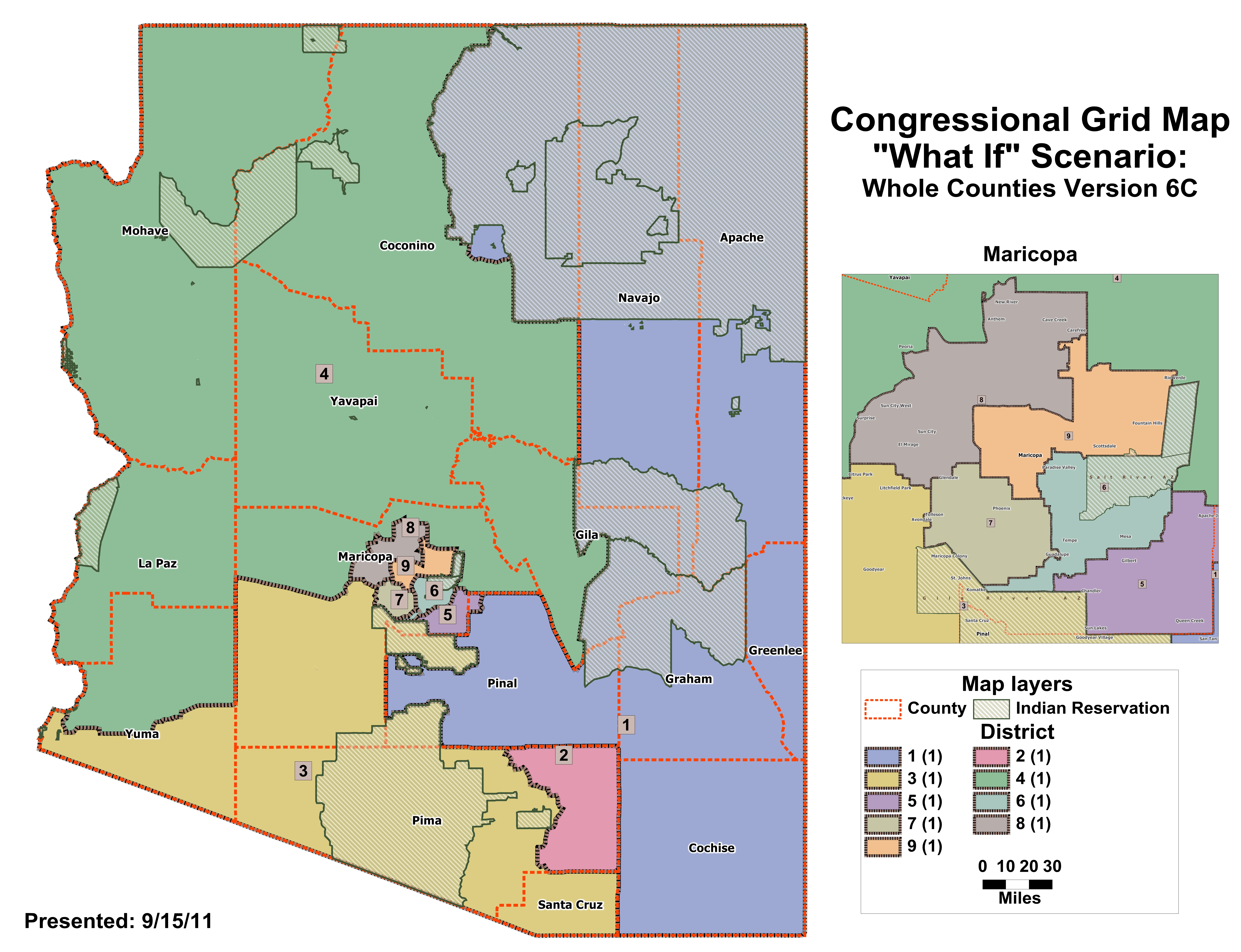
| "What If" Congressional Whole Counties v6c |
| Available File Types: |
|
|
|
|
|
|
|
|
|
| Data below is for the meeting on September 14, 2011 |
| "What If" Congressional Whole Counties v5a |
| Available File Types: |
|
|
|
|
|
|
|
|
|
| "What If" Congressional Whole Counties v5b |
| Available File Types: |
|
|
|
|
|
|
|
|
|
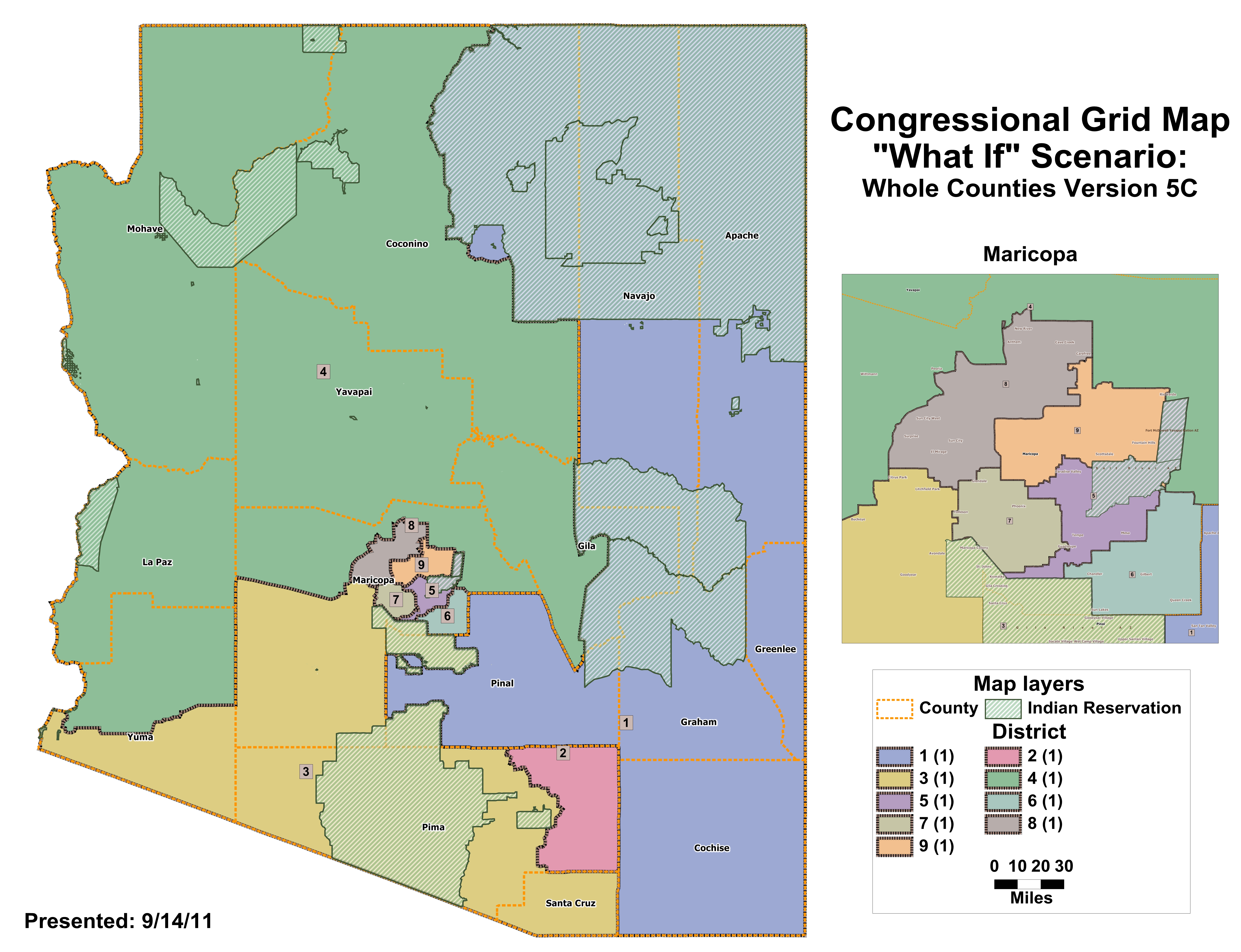
| "What If" Congressional Whole Counties v5c |
| Available File Types: |
|
|
|
|
|
|
|
|
|
| Data below is for the meeting on September 12, 2011 |
| Arizona Population Density - 34mb JPG File |
| "What If" Congressional River 3 Border Combo version 1a |
| Available File Types: |
|
|
|
|
|
|
|
|
|
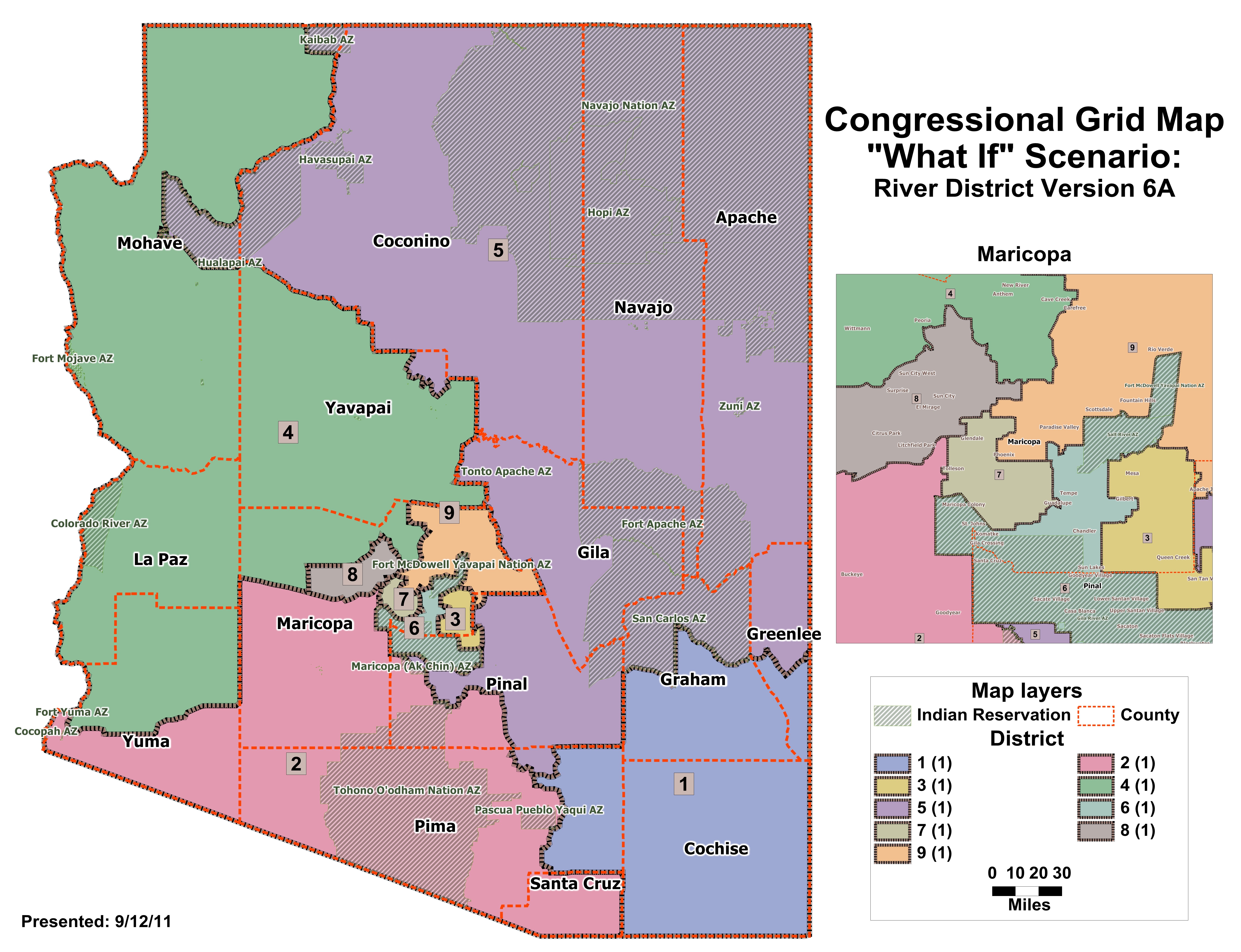
| "What If" Congressional River District version 6a |
| Available File Types: |
|
|
|
|
|
|
|
|
|
| "What If" Legislative 9 Minority Districts option 1 v5 |
| Available File Types: |
|
|
|
|
|
|
|
|
|
| "What If" Legislative 9 Minority Districts option 2 v5 |
| Available File Types: |
|
|
|
|
|
|
|
|
|
| Data below is for the meeting on September 9, 2011 |
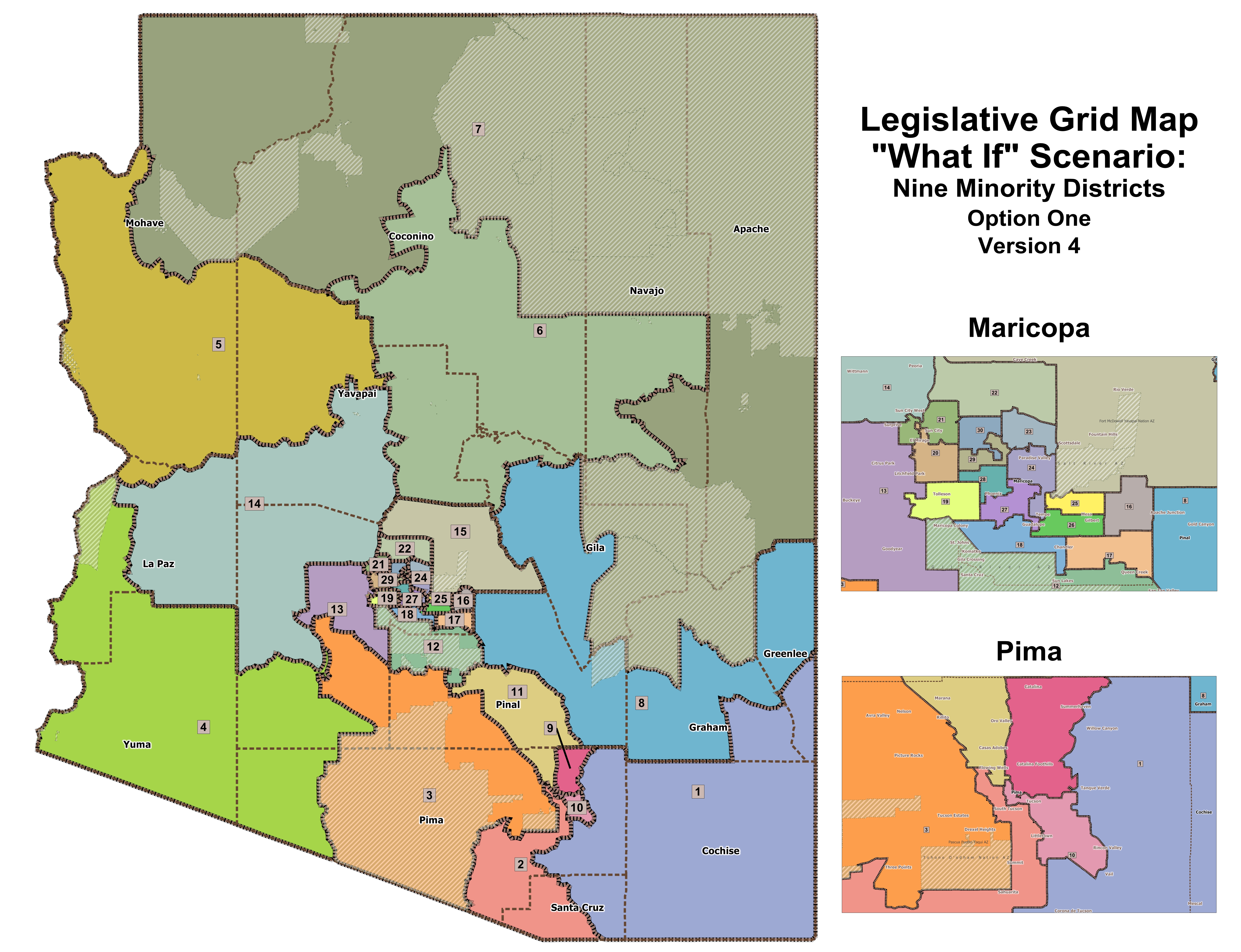
| "What If" Legislative 9 Minority Districts Option 1 v4 |
| Available File Types: |
|
|
|
|
|
|
|
|
|
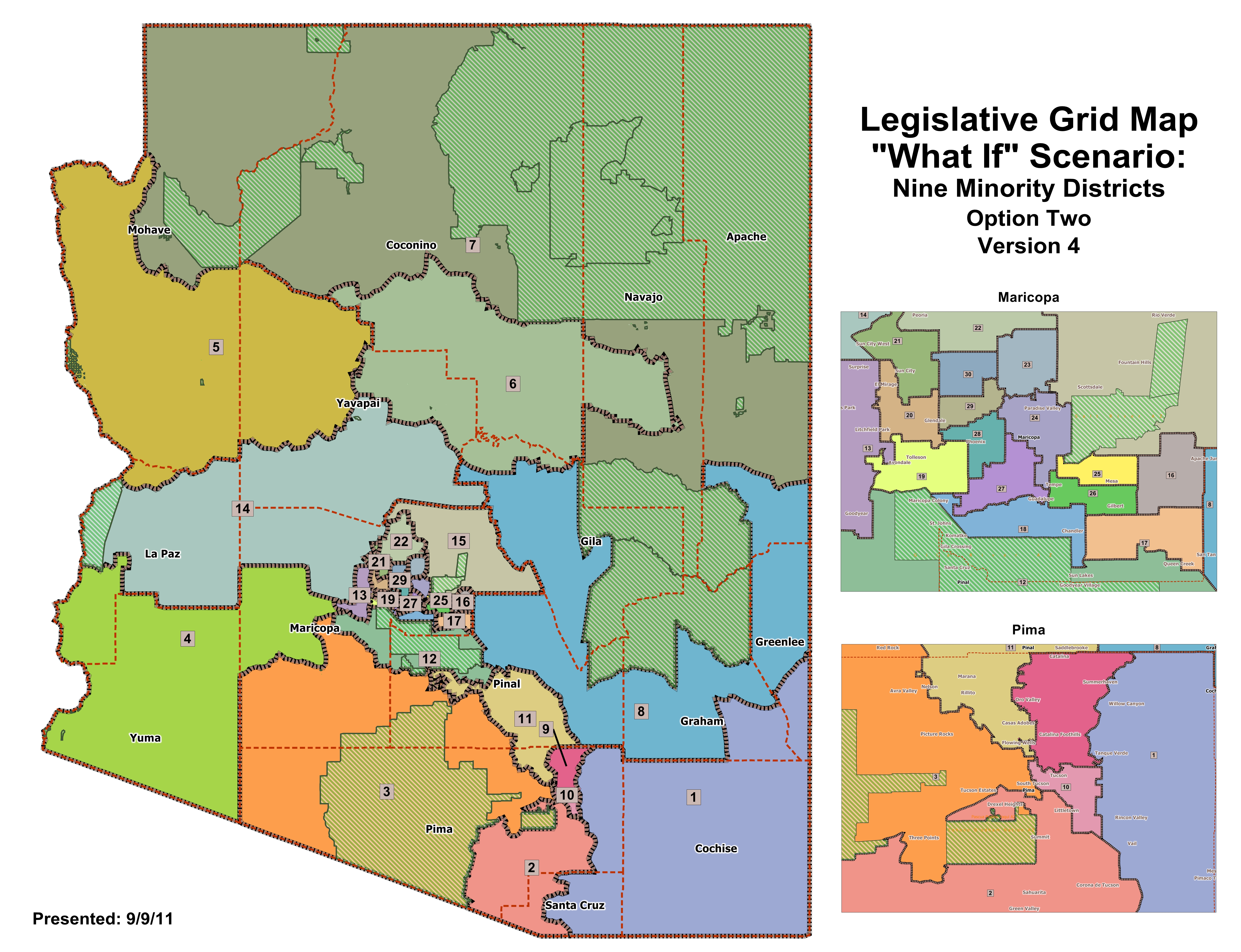
| "What If" Legislative 9 Minority Districts Option 2 v4 |
| Available File Types: |
|
|
|
|
|
|
|
|
|
| Data below is for the meeting on September 8, 2011 |
| "What If" Congressional 3 Border District v2 |
| Available File Types: |
|
|
|
|
|
|
|
|
|
| "What If" Congressional River District v5 |
| Available File Types: |
|
|
|
|
|
|
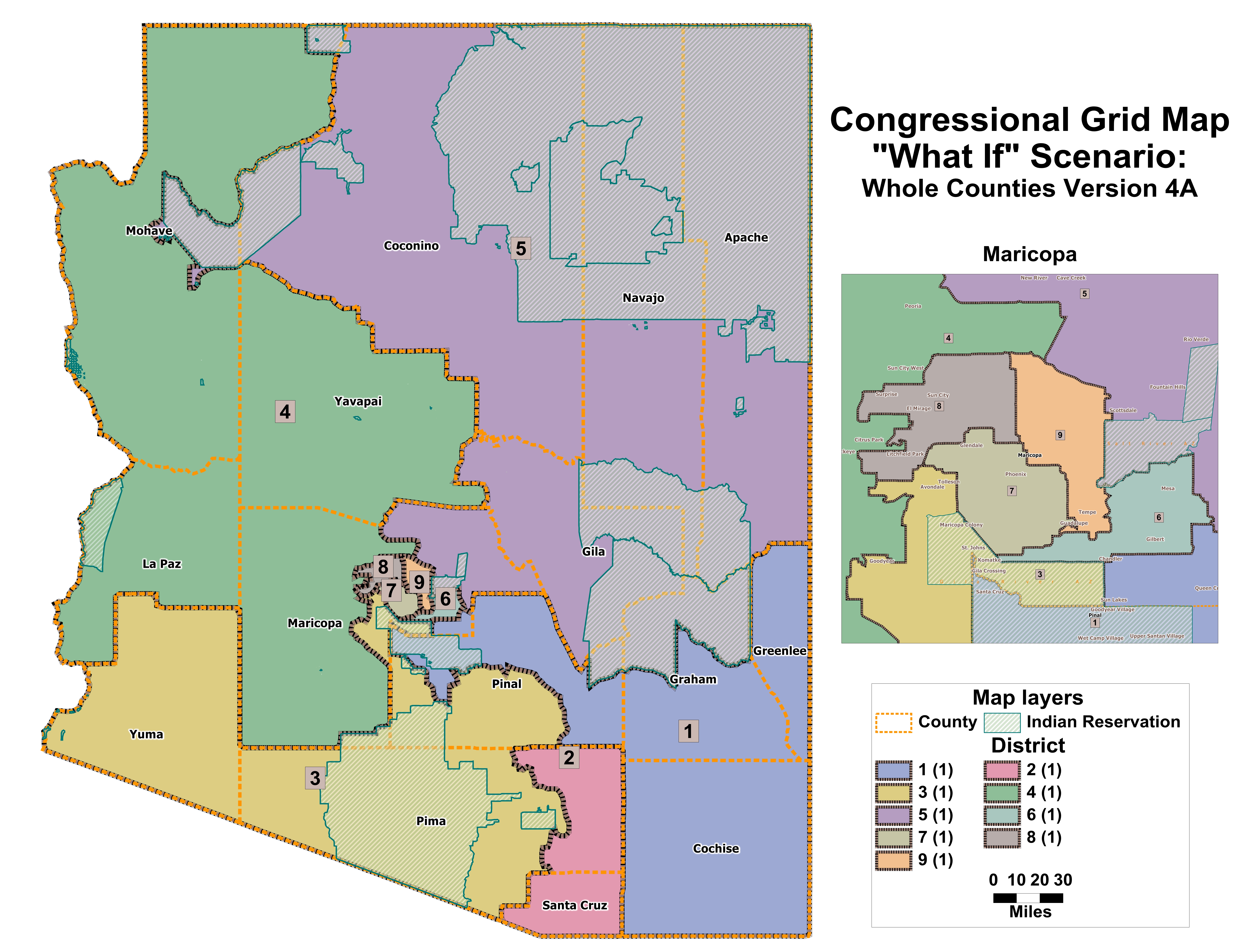
| "What If" Congressional Whole Counties v4a |
| Available File Types: |
|
|
|
|
|
|
|
|
|
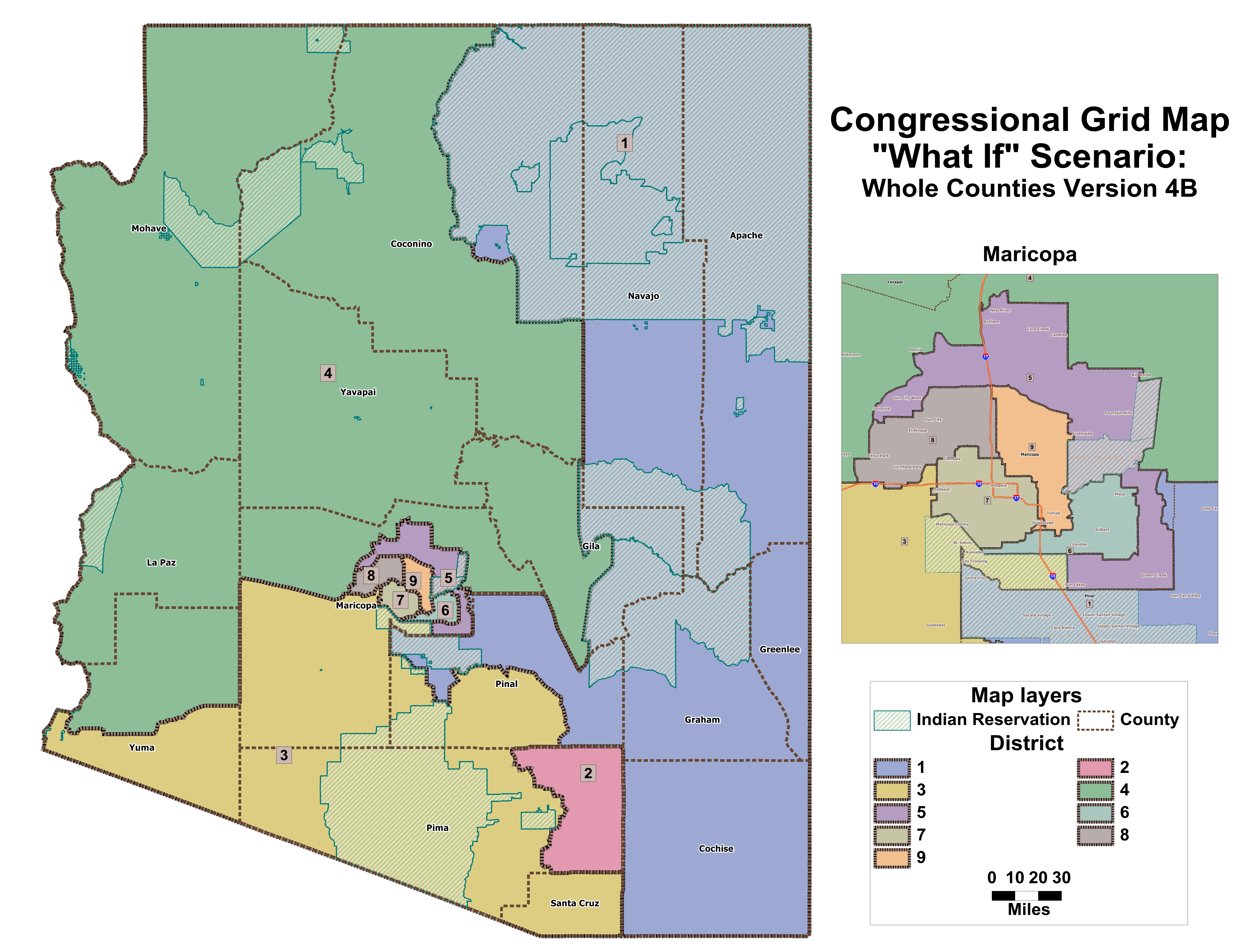
| "What If" Congressional Whole Counties v4b |
| Available File Types: |
|
|
|
|
|
|
|
|
|
| "What If" Legislative 9 Minority District option1 |
| Available File Types: |
|
|
|
|
|
|
|
|
|
| "What If" Legislative 9 Minority District option2 |
| Available File Types: |
|
|
|
|
|
|
|
|
|
| Data below is for the meeting on September 3, 2011 |
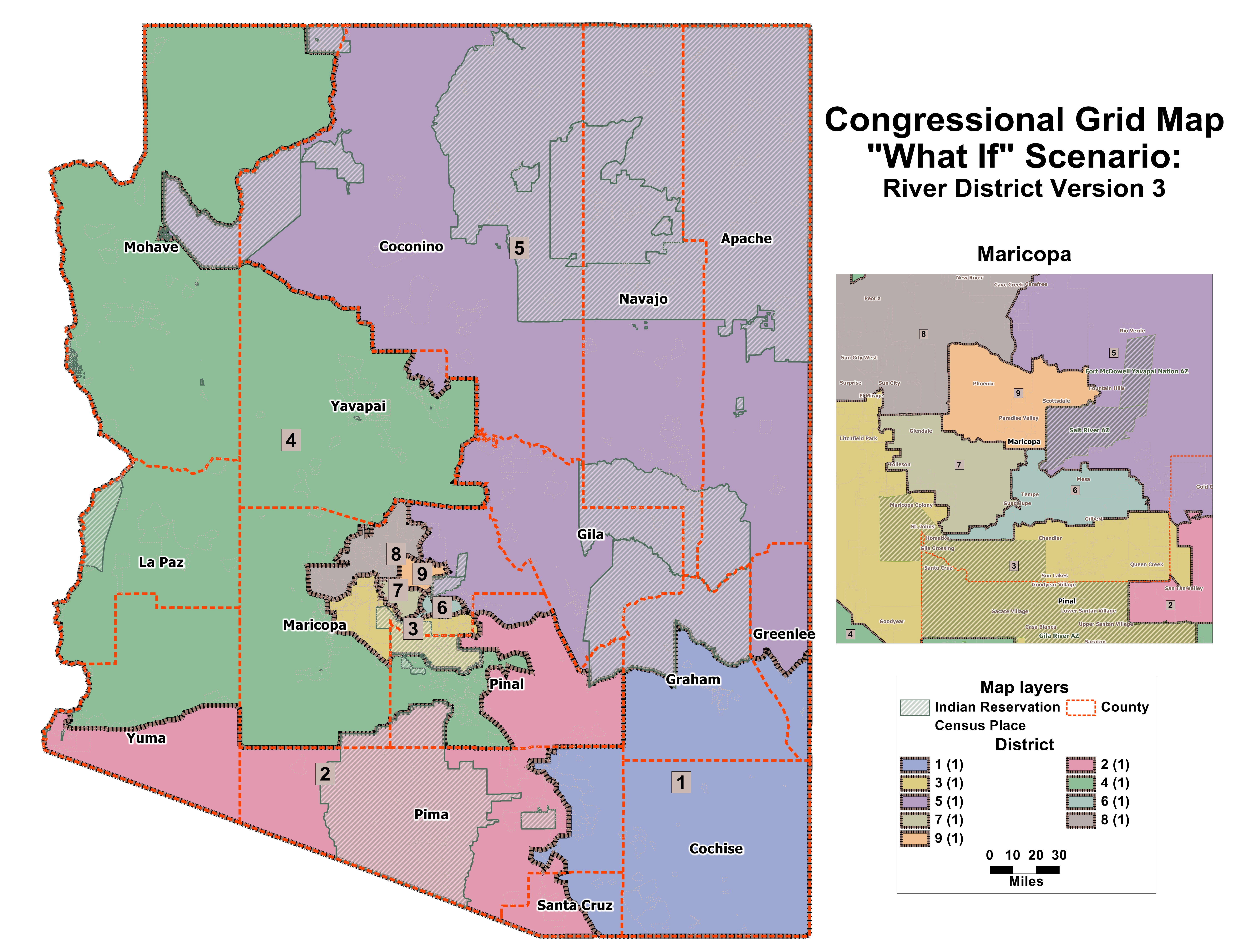
| "What If" Congressional Grid Map - River District version 3 |
| Available File Types: |
|
|
|
|
|
|
|
|
|
|
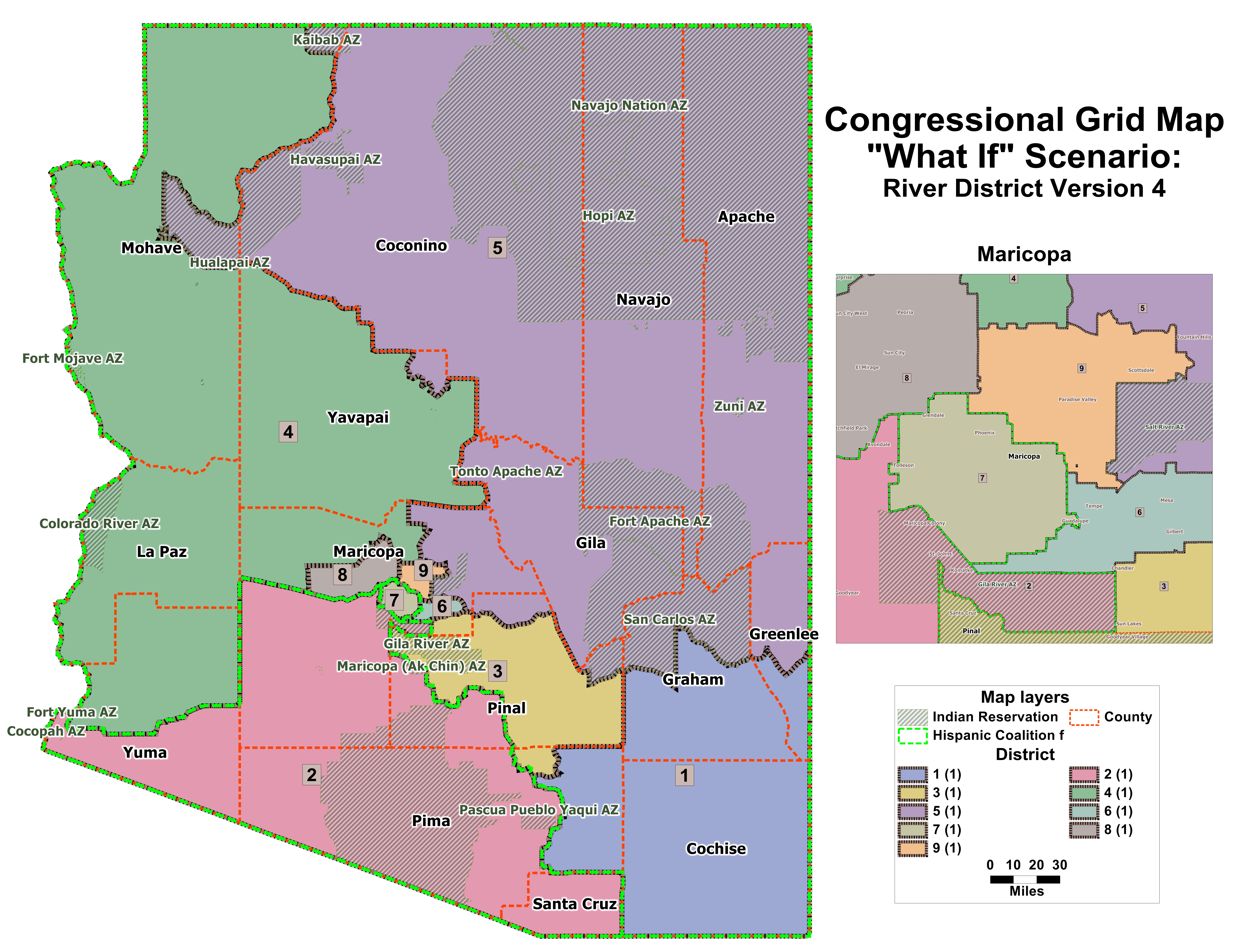
| "What If" Congressional Grid Map - River District version 4 |
| Available File Types: |
|
|
|
|
|
|
|
|
|
|
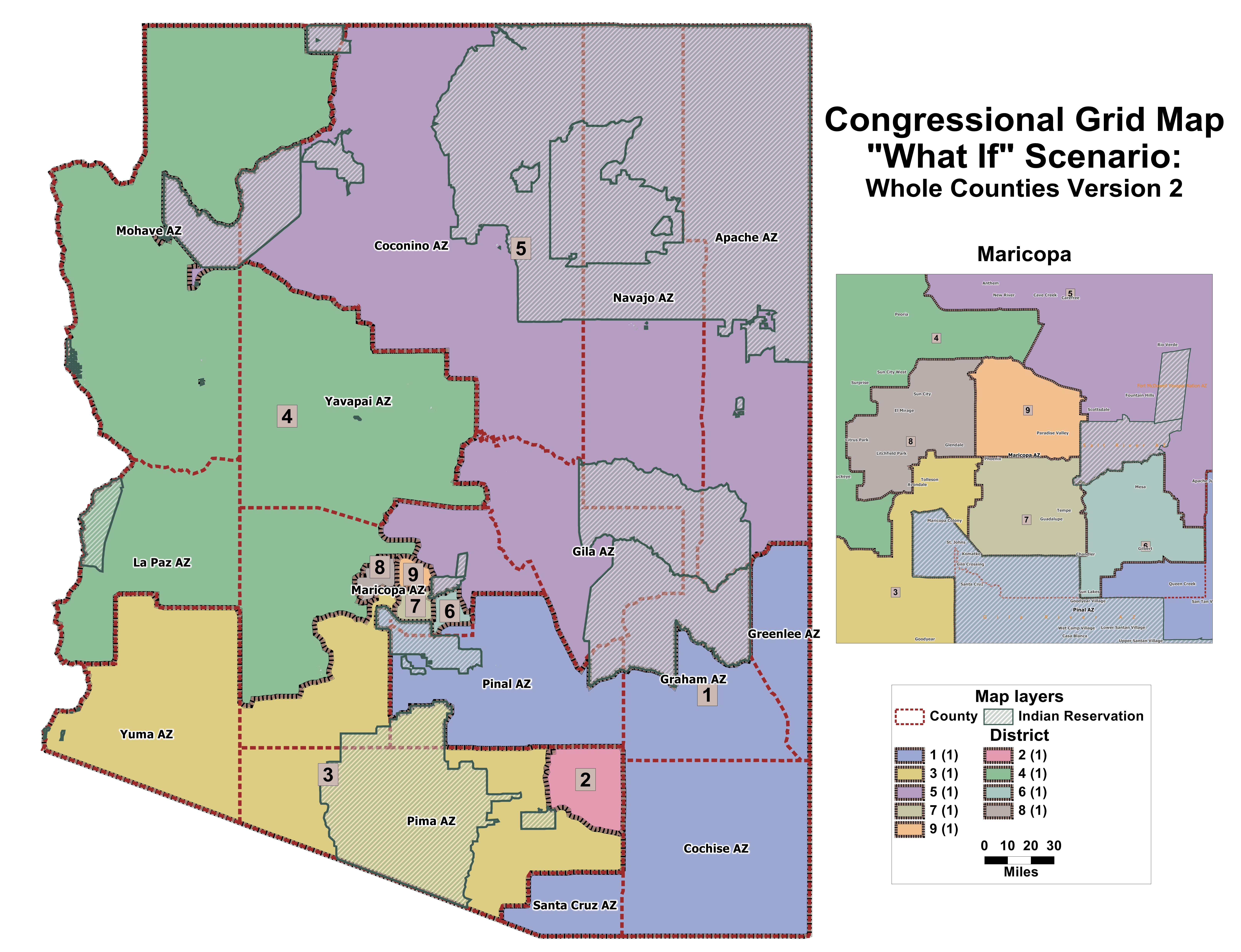
| "What If" Congressional Grid Map - Whole Counties version 2 |
| Available File Types: |
|
|
|
|
|
|
|
|
|
|
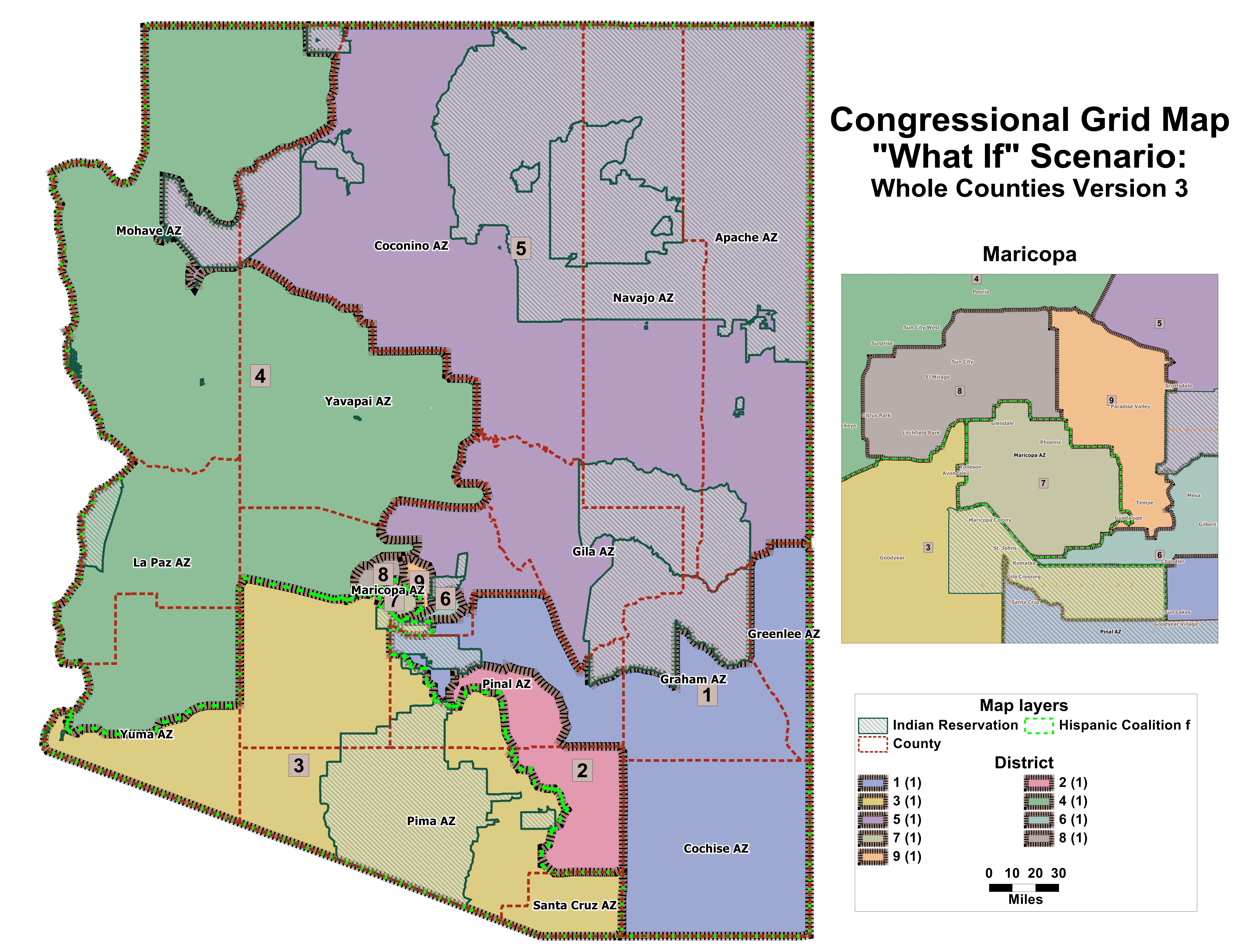
| "What If" Congressional Grid Map - Whole Counties version 3 |
| Available File Types: |
|
|
|
|
|
|
|
|
|
|
| Data below is for the meeting on September 2, 2011 |
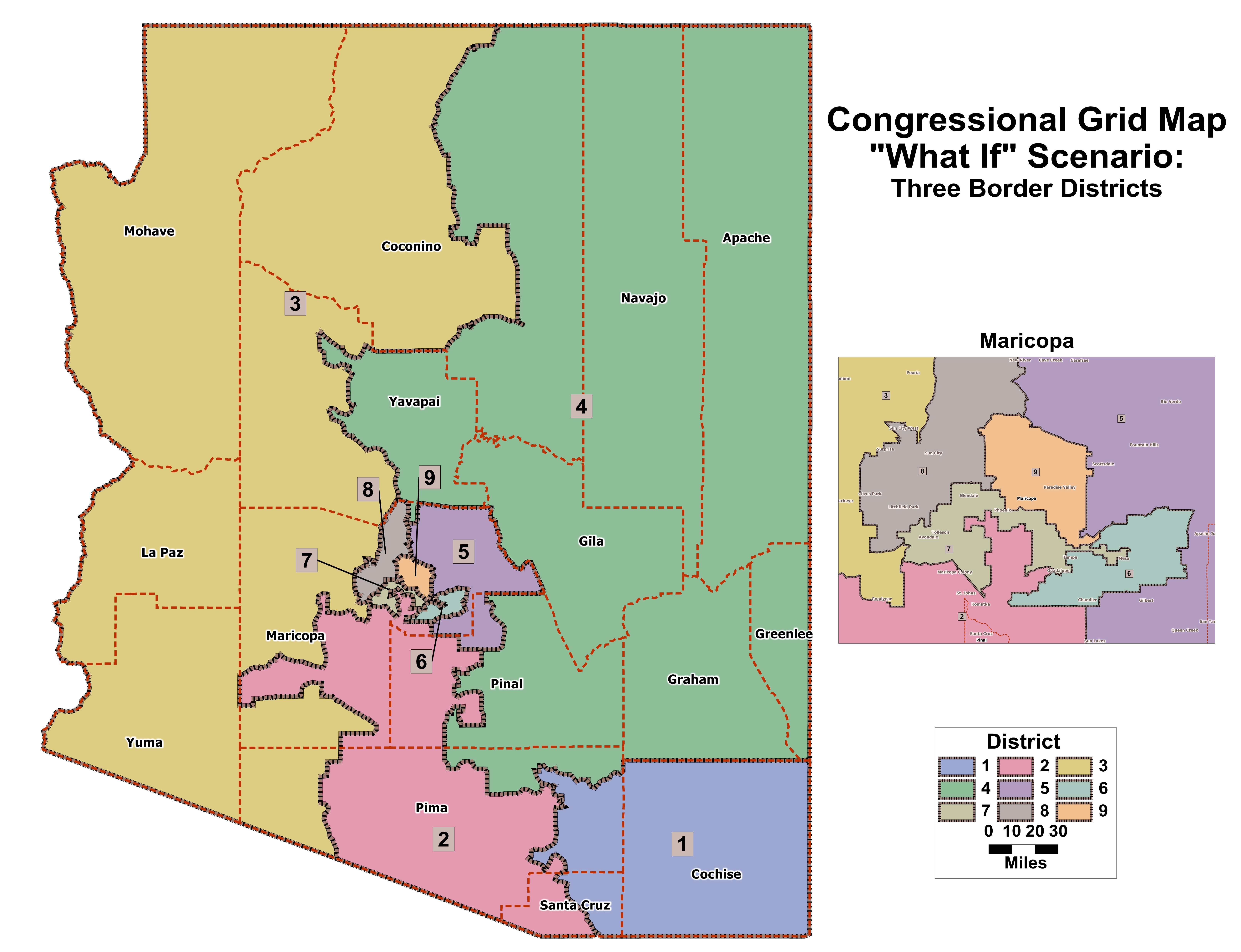
| "What If" Congressional Grid Map - 3 Border Districts |
| Available File Types: |
|
|
|
|
|
|
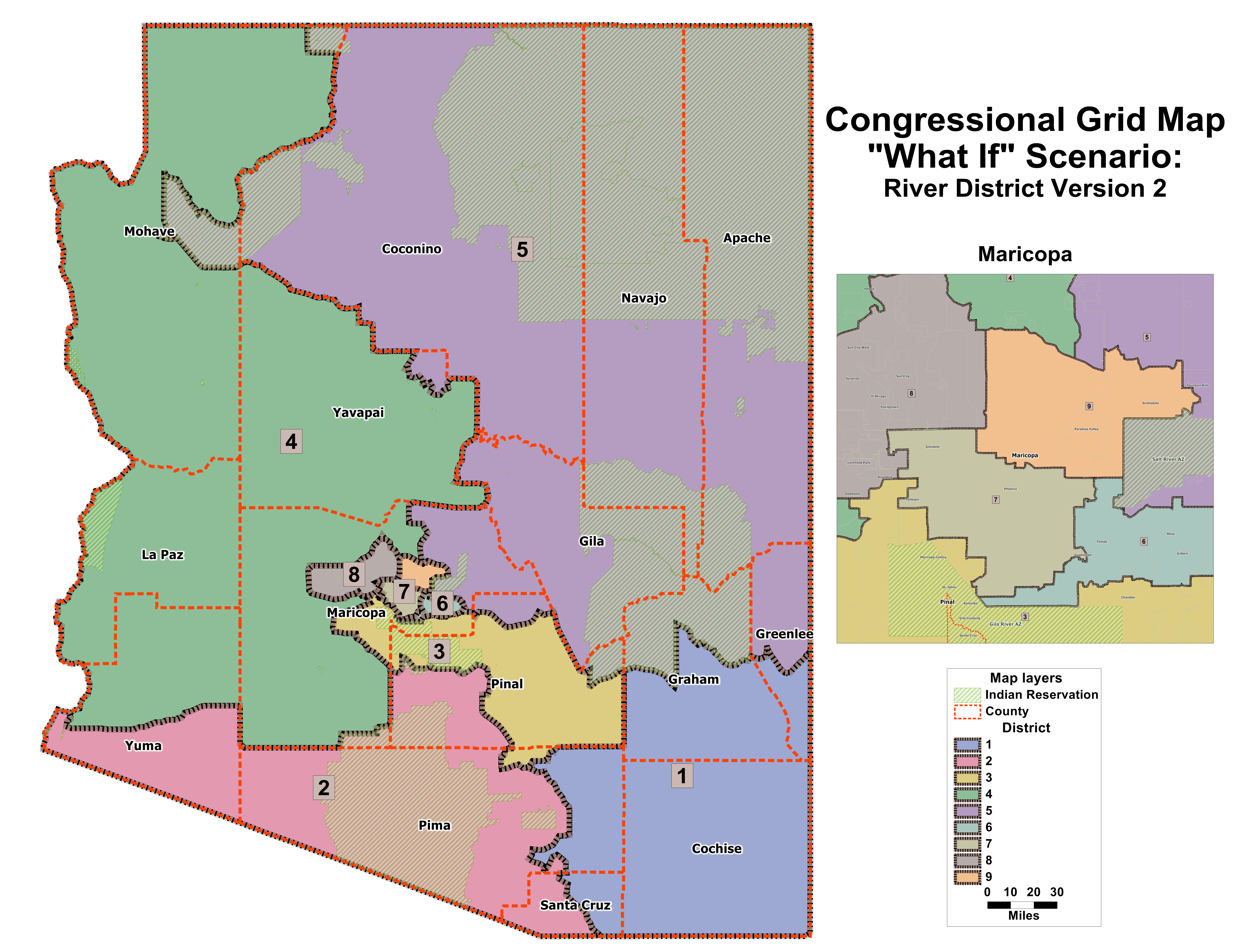
| "What If" Congressional Grid Map - River District Version 2 |
| Available File Types: |
|
|
|
|
|
|
| "What If" Legislative 9 Grid Map - Minority Districts option 1 no split |
| Available File Types: |
|
|
|
|
|
|
| "What If" Legislative 9 Grid Map - Minority Districts option 2 no split |
| Available File Types: |
|
|
|
|
|
|
| Data below is for the meeting on August 31, 2011 |
| "What If" Congressional Grid Map - Minimize Split Counties |
| Available File Types: |
|
|
|
|
|
|
| "What If' Congressional Grid Map - No Split Indian Reservations |
| Available File Types: |
|
|
|
|
|
|
|
|
|
|
| "What If" Congressional Grid Map - River Districts |
| Available File Types: |
|
|
|
|
|
|
|
|
|
|
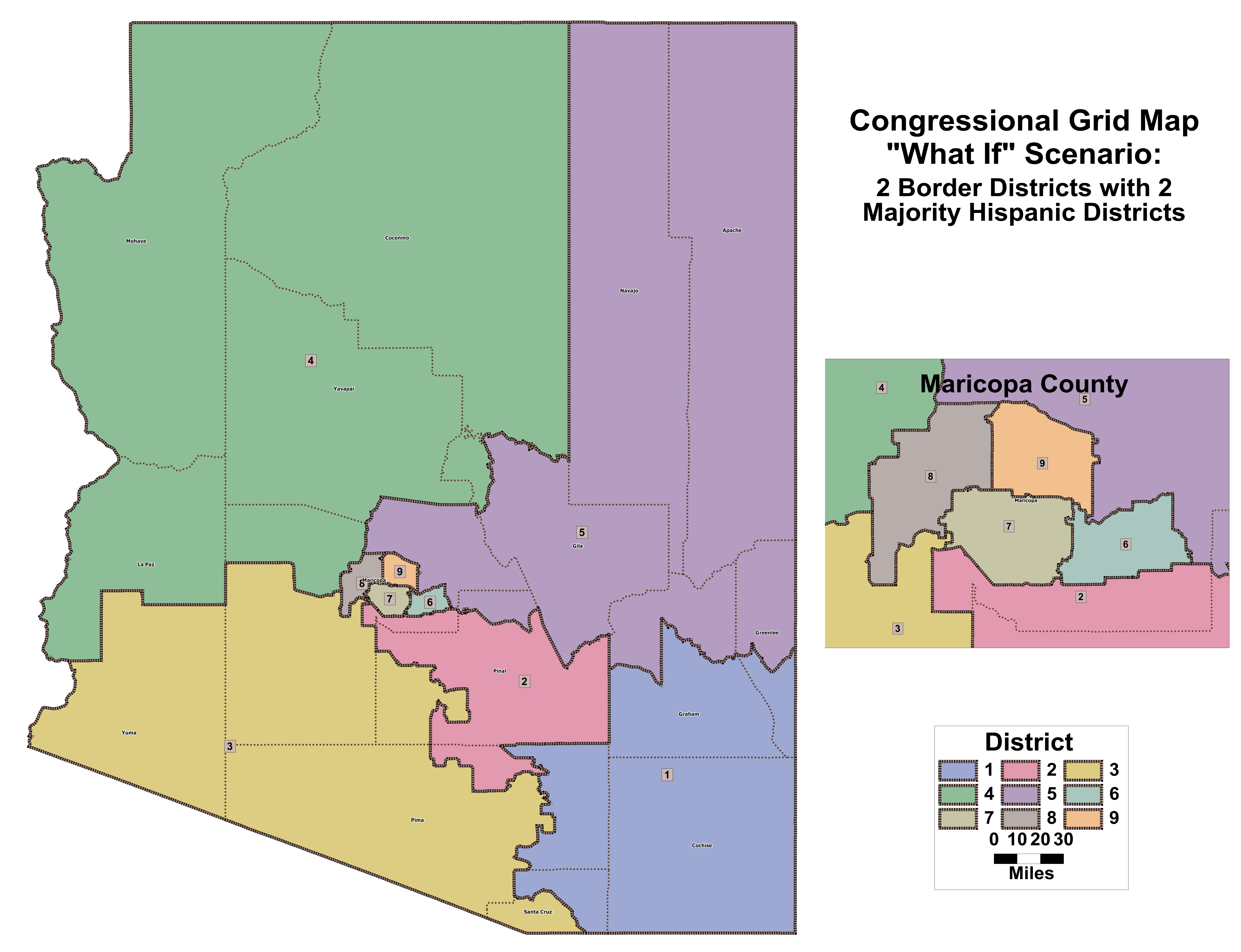
| "What If" Congressional Grid Map - 2 Border District with 2 Majority Hispanic District |
| Available File Types: |
|
|
|
|
|
|
|
|
|
|
| "What If" Legislative Map - 9 Voting Rights Act Districts Option 1 |
| Available File Types: |
|
|
|
|
|
|
|
|
|
|
| "What If" Legislative Map - 9 Voting Rights Act Districts Option 2 |
| Available File Types: |
|
|
|
|
|
|
|
|
|
|


