2001 Maps
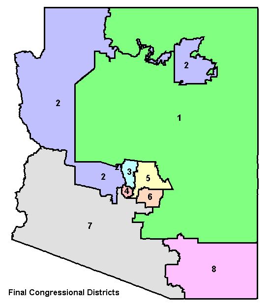
Final Congressional District Map
The maps presented here have been adopted as final district maps by the Arizona Independent Redistricting Commission. The Congressional map was precleared by the US Department of Justice (DoJ) in the Spring of 2002.
Maps
Adobe Acrobat Maps
Reports
- Demographics
- Certification List
- Cities, Towns, and Places List: By District, By Name
Data
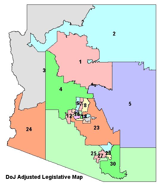
Precleared Legislative District Map
The maps presented were originally adopted as final district maps by the Arizona Independent Redistricting Commission. The map was precleared by the US Department of Justice (DoJ) who reviewed it for compliance with Section 5 of the Voting Rights Act.
Maps
Reports
- Demographics
- Cities, Towns, and Places List: By District, By Name
Data
Interim 2002 Legislative District Map
The maps presented here have been adopted as final district maps by the Arizona Independent Redistricting Commission. The Legislative Map was adopted by the Commission May 23rd, 2002 following the DoJ objection to the original Legislative Districts adopted by the Commission. The districts shown here have been adjusted to address the issues raised by DoJ and were ordered to be used in the Fall 2002 elections by a federal three judge panel. These are the districts that are currently in effect for representation.
Maps
Adobe Acrobat Maps
Reports
- Cities, Towns, and Places List: By District, By Name
April 12, 2004 Court-Ordered Map and Tests
The Independent Redistricting Commission held meetings starting in February 2004 to review the Legislative Districts to comply with the court ruling on the Precleared 2002 Legislative District Map. This page lists various test maps, reports, or data products produced for the Commission by outside consultants or analysts.
Please note that not all of this material has been adopted by the Commission. It has been developed to assist in the redistricting process and is presented here for information only.
GIS Data is unprojected Decimal Degrees, NAD83 Datum
Information from April 12th Meeting
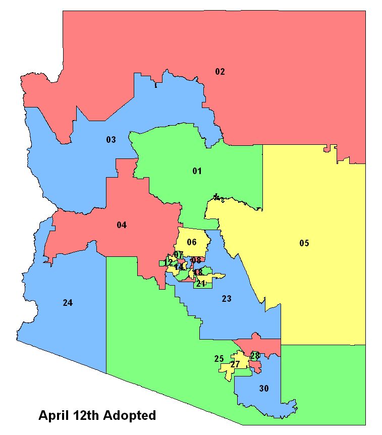
April 12th Adopted
The Commission adjusted the "April 2 Adopted" map to create this map in response to public comments received and for minor technical changes. This map was approved by the court and submitted to the Department of Justice for preclearance.
Maps
Reports
Information from April 2nd Meeting
District Tests:
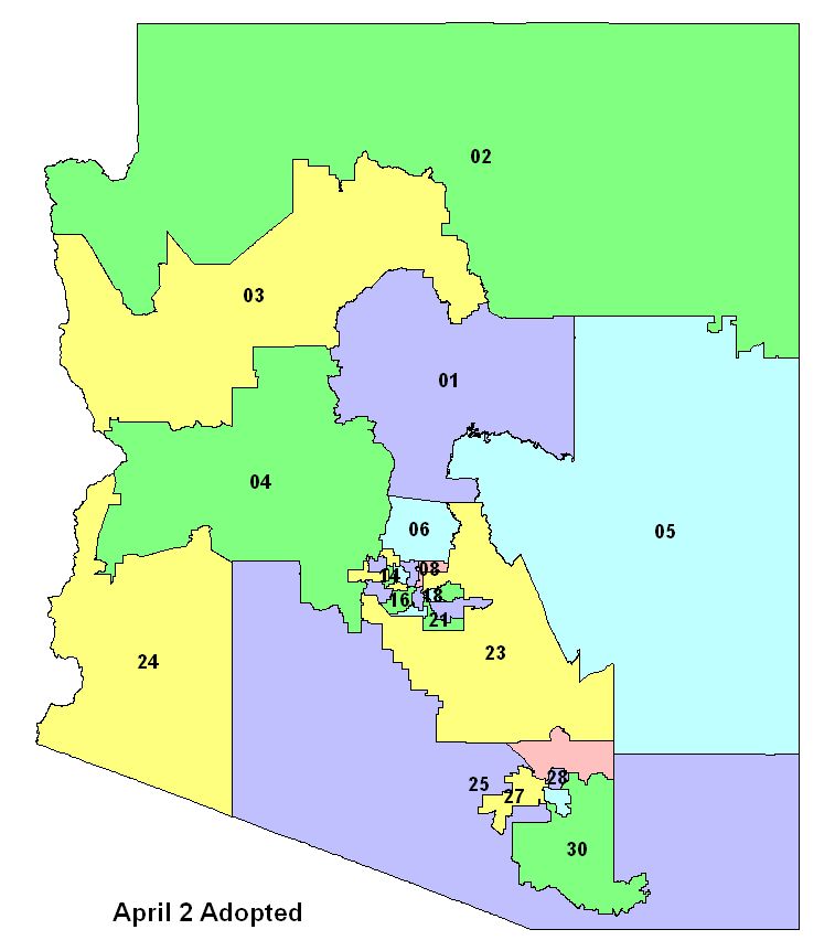
April 2nd Adopted
The Commission adjusted the "March 1st Numbered" map to create this map in response to public comments received during the Comment Period.
Maps
Information from March 1st Meeting
District Tests:
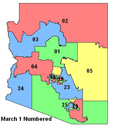
March 1 Numbered
The Commission adjusted the Feb 23rd test to create this map and approved it to be presented to the court on March 5. This is the same map as below, with district letters changed to numbers.
Maps
Reports
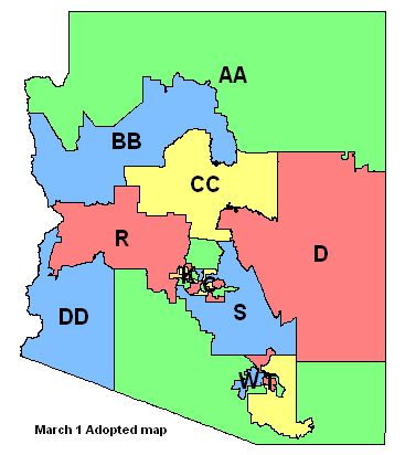
March 1 Adopted
The Commission adjusted the Feb 23rd test to create this map and approved it to be presented to the court on March 5.
Maps
Data
Information from February 21st - 25th Meetings
District Tests:
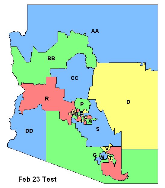
Feb 23 Test
The Commission approved this test for trap adjustments and population balancing changes. Those adjustments will be made on March 1. The map will then be presented to the court on March 5. Public comments on this test are welcome until March 1 unless an extension of time for public comment is approved by the court.
|
Feb 23 Test Maps |
Reports |
Data |
|
Feb 22 Tests A Maps |
Reports |
Data |
|
Feb 22 Tests B Maps
|
Reports |
Data |
|
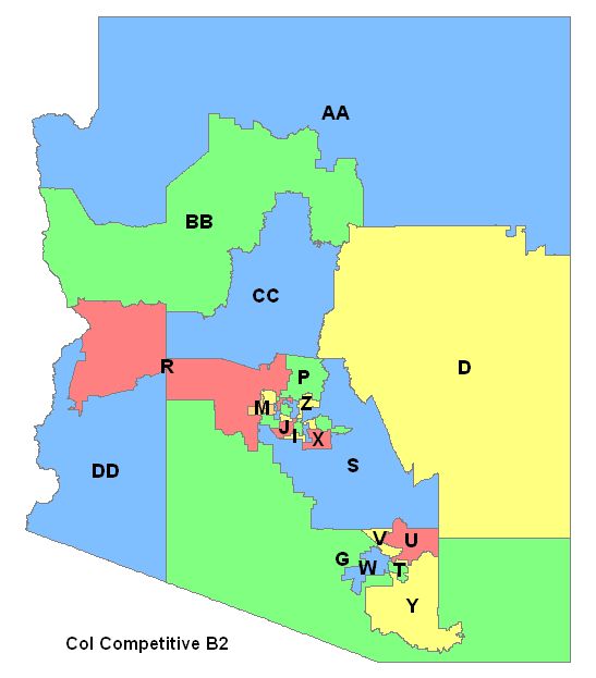
CoI Competitive B2 Maps
|
Reports |
Data |
|
CoI Competitive C2 Maps |
Reports |
Data |
|
CoI Competitive A Maps |
Reports |
Data |
|
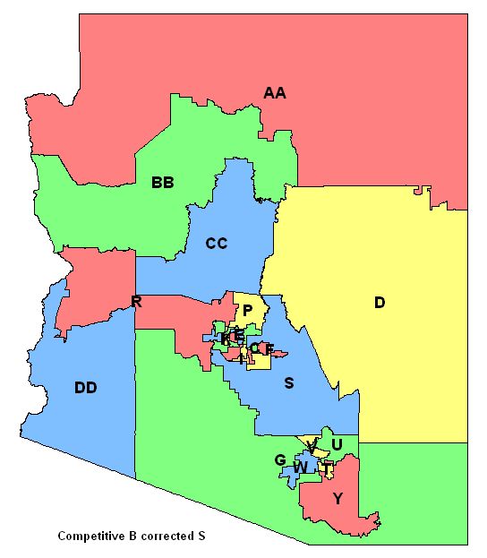
Competitive B corrected S Maps |
Reports |
Data |
|
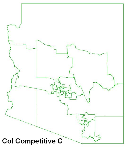
CoI Competitive C Maps |
Reports |
Data |
|
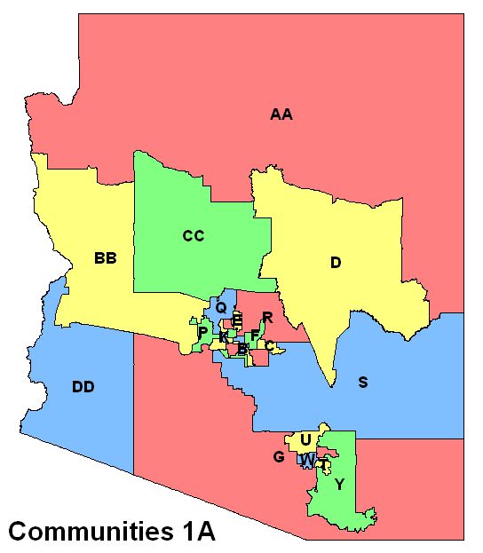
Communities 1A Maps |
Reports |
Data |
|
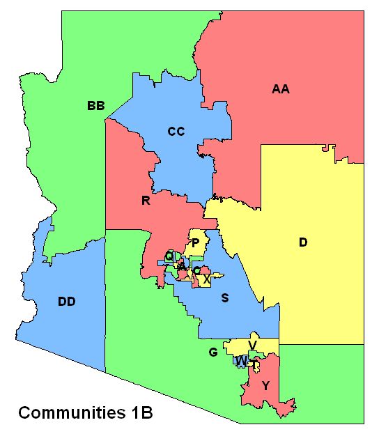
Communities 1B Maps |
Reports |
Data |
|
Communities 2A Maps |
Reports |
Data |
|
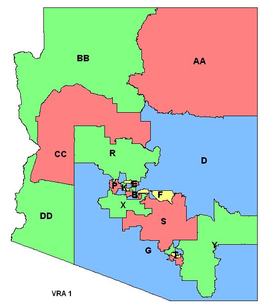
VRA 1 Maps |
Reports |
Data |
|
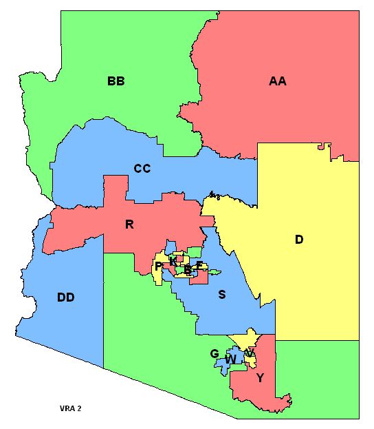
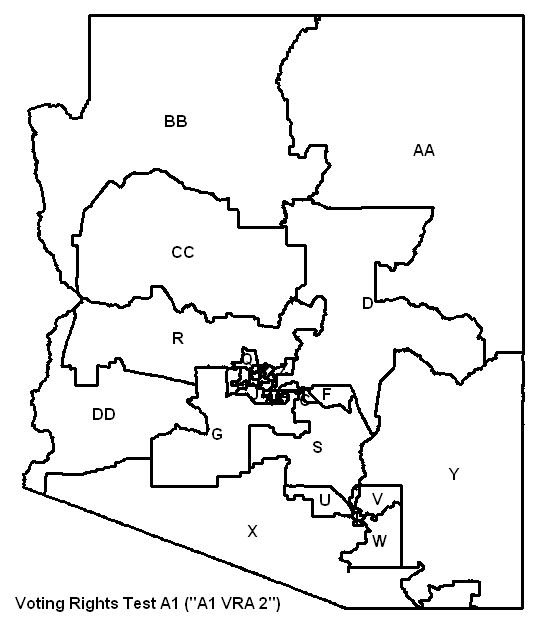
VRA 2 Maps |
Reports |
Data |
Information from February 5th - 9th Meetings
Presentations:
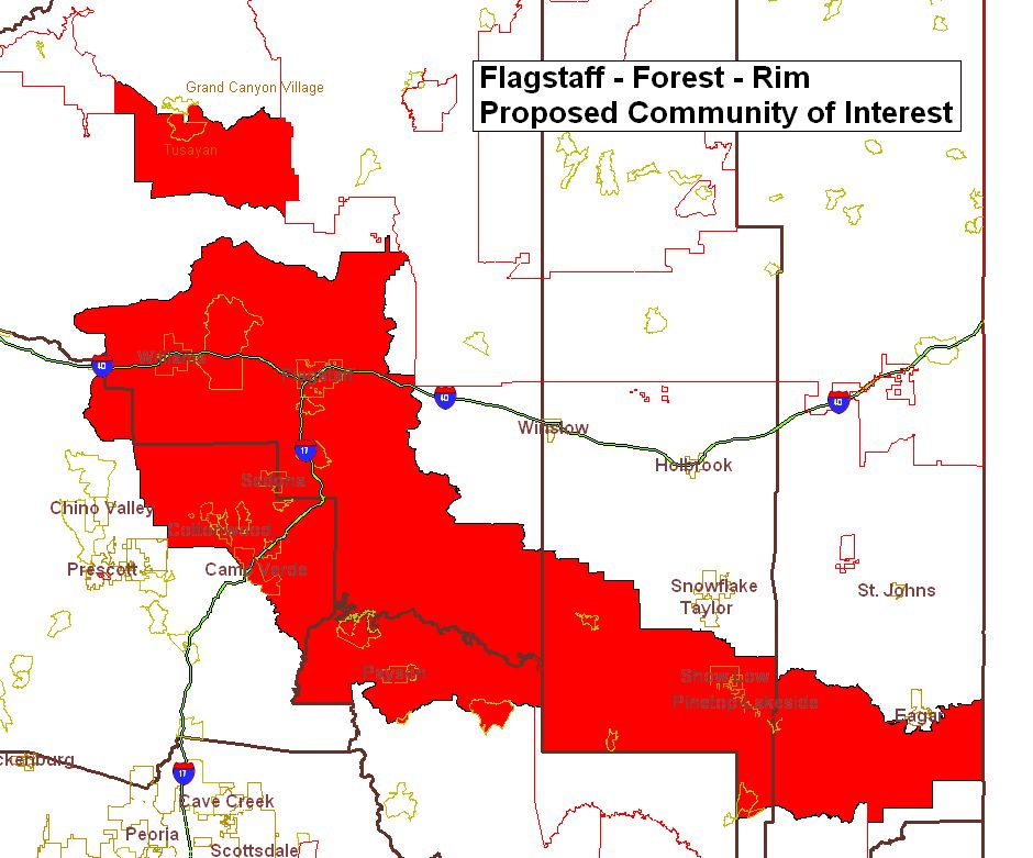
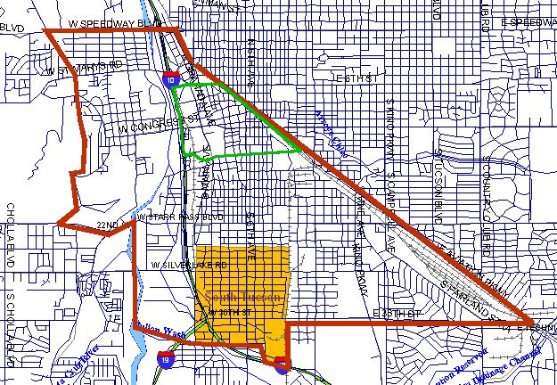
* Communities of Interest (Feb 5th) PowerPoint (11MB file)
two more communities of interest were discussed that are not in the presentation, and one more was submitted:
- Flag - Forest - Rim proposed CoI
- South Tucson Map
- Central Yavapai Metropolitan Planning Organization (CYMPO)
* Competitiveness Testing (Feb 9th) PowerPoint
* Example of Voting Rights Act Adjustments to a Competitive Map (Feb 9th) PowerPoint
Reports:
* Competitiveness Report (Feb 9th)
* Competitiveness Report, Voting Rights Test A1 VRA 2
District Tests:
|
Competitive Test A1 Maps |
Reports |
Data
|
|
Competitive Test A2 Maps |
Reports |
Data |
|
Competitive Test B1 Maps |
Reports |
Data |
|
Competitive Test B2 Maps |
Reports |
Data |
|
Voting Rights Test A1 Maps |
Reports |
Data |
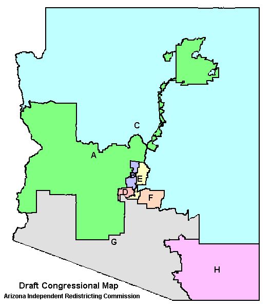
Draft District Maps
The maps presented here were adopted as draft district maps by the Arizona Independent Redistricting Commission in August 2001. The draft maps incorporated modifications to the initial grids to accommodate many of Proposition 106's redistricting goals such as respect for "Communities of Interest". The maps were available for public comment for at least thirty days.
Congressional Draft Map
Initial Grids
The Arizona Independent Redistricting Commission adopted the Equal Population Grids for the Congressional and Legislative Districts on June 7, 2001. The grid was required by Proposition 106 as the initial starting point for districts and was based on Arizona's Township, Range, and Section Public Land Survey System.